Semyon Ulyanovich Remezov (1642, Tobolsk, Russian Tsardom - after 1721, ibid.) - Russian encyclopedist of Siberia - cartographer, architect, builder, historian, artist, writer.
Remezov entered the history of Russia primarily as a cartographer. He compiled three unique atlases - “ Chorographic drawing book"- original:: Gufton Library, Harvard College Library N59-2045, published by The Atlas of Siberia by Semyon U.Remesov. Facsimile edition with an introduction by Leo Bagrow. s`Gravenhage, 1957, " Drawing book of Siberia 1701" - original: Department of Manuscripts of the Russian State Library (Moscow), Rumyantsev Collection N346, published: "Drawing Book of Siberia, Compiled by the Boyar's Son Semyon Remezov in 1701", St. Petersburg, 1882, and " Service drawing book" - original: Department of Manuscripts of the Russian National Library (St. Petersburg) Hermitage collection N237. All of them are the most valuable monuments of Russian cartography
DRAWING BOOK OF SIBERIA
One of the earliest monuments of Russian cartography that has reached us is “ Drawing book of Siberia", compiled in 1699 - 1701 by the remarkable Russian geographer, cartographer and topographer S. U. Remezov and his sons. True, it saw the light only in 1882, when it was published by the Archaeological Commission. Of course, it had some conventional representation; it lacked a degree grid, but the “drawing book” for the first time provided an opportunity to imagine the vast territory of Russia, the flow of rivers, settlements, and information about the population of Siberia.
KUNGUR CHRONICLE
Remezov Chronicle (also “ Tobolsk chronicler », « Siberian history" And " Chronicle of Siberia, brief Kungur") - one of the Siberian chronicles.
The time of writing the chronicle dates from the end of the 17th century to 1703. The author is considered to be Semyon Ulyanovich Remezov, the participation of his sons and father is also possible.
The chronicle tells about Ermak's campaign in Siberia and is divided into 157 (154) chapters. It is based both on various oral sources and on the chronicle of Savva Esipov (1636). It also includes the Kungur Chronicle.
The Remezov Chronicle is equipped with 154 black and white drawings, which makes it different from other Siberian chronicles. Each image takes up 9/10 of the page, 1/10 of the page is text. These drawings were probably influenced by the illustrations of the Royal Book and the engravings of the Synopsis by Innocent Gisel. The drawings of the Kungur Chronicle included in it are distinguished by a different style of execution.
CHOROGRAPHIC BOOK OF SIBERIA (1697—1711) - COMPLETE DESCRIPTION OF SIBERIA BY S.U. REMEZOV
The history of this book is contradictory and in many ways unclear - although the book is dedicated to Peter I, it was not given to him. In Russia it is almost unknown. Original "
Remezov, Semyon Ulyanovich
| Semyon Ulyanovich Remezov | |
Silhouette of the monument to Semyon Remezov against the background of the sky and St. Sophia Cathedral of the Tobolsk Kremlin |
|
| Basics | |
|---|---|
| Citizenship |
Kingdom of Russia |
| Date of birth | |
| Date of death | |
| Place of death | |
| Works and achievements | |
| Worked in cities |
Tobolsk |
| Major buildings | |
| Urban development projects |
Plans and descriptions of Tobolsk and Tobolsk district and much more |
| Scientific works |
“Chorographic Book of Siberia” (1697–1711), “Drawing Book of Siberia” (1699-1701) - the first Russian geographical atlas, “Service Book of Siberia”. |
| Semyon Ulyanovich Remezov on Wikimedia Commons | |
Semyon Ulyanovich Remezov(near, Tobolsk, Russian Tsardom - after, Tobolsk, Russian Tsardom) - Russian encyclopedist of Siberia - cartographer, architect, builder, historian, artist, writer.
Remezov entered the history of Russia primarily as a cartographer. He compiled three unique atlases - “Chorographic Book of Siberia”, “Drawing Book of Siberia” and “Service Book of Siberia”. All of them are the most valuable monuments of Russian cartography.
Semyon Ulyanovich Remezov belonged to the service class of boyar children. Activities of S.U. Remezova is incredibly diverse. He took part in repelling raids from the territory of modern Kazakhstan, in clashes with non-peaceful Vogulichs and Tatars, collected tribute, founded new villages, and conducted a population census. Remezov was the architect and construction manager of the only stone Kremlin in Siberia, in Tobolsk. He drew up drawings of the city's stone fortifications, calculated estimates for the work and supervised the construction, which began in 1697. Along the way, he searched for lime, ensured the extraction of clay, the construction of brick kilns and their production, was responsible for the supply of workers, the supply of wooden piles, looked for sand and rubble stone.
According to Remezov’s drawings, not only the Tobolsk Kremlin was built, but also the most important administrative buildings of the city: the Prikaznaya Chamber, the Gostiny Dvor; he also developed an exemplary design for a stone house for mass private development. In Tyumen, in the Trinity Monastery, the Peter and Paul Church was built according to Remezov’s design. He drew up not only plans for the state-owned Kamensk metallurgical plant, but also drawings of artillery pieces and cannonballs produced there. He was searching for saltpeter and creating a gunpowder factory.
He is the author of the works “On the borders and boundaries of all Siberia”, “Similarity of Siberian countries”, “Description of Siberia” and others. Historical-toponymic and ethnographic-geographical problems of the origin of the peoples of Siberia were considered by Remezov in “Description of the Siberian peoples and the facets of their lands” (1697–98). The events of the annexation of Siberia were described by him in the illustrated Remezov Chronicle, consisting of the “History of Siberia” (90s of the 17th century) and the “Short Chronicle of Siberia Kungur” (after 1703). In literature, the chronicle is known as the “Remezov Chronicle”, “Tobolsk Chronicle”, “Brief Siberian Chronicle”, “Kungur Chronicle”.)
Cause of death S.U. Remezov is unknown; most likely, as L. Martynov writes, he “burned out” at work.
Chorographic book of Siberia (1697–1711)
The history of this book is contradictory and in many ways unclear - although the book is dedicated to Peter I, it was not given to him. In Russia it is almost unknown. The original “Chorographic Book” was discovered in the archive of ancient acts of Russia only at the beginning of the 20th century. For many years the book was considered lost, but in 1958 the manuscript appeared in the form of a phototype edition (Atlas of Siberia, Amsterdam, black and white, prepared for publication by L.S. Bagrov) - the original atlas, taken out (actually stolen) by the historian L.S. . Bagrov from Russia in 1918, from 1956 to the present day kept in the Houghton Library at Harvard University.
Since the mid-1990s Researchers are increasingly turning to individual sheets of the “Chorographic Book”, which contain the most valuable information on cartography, history, archeology and ethnography of the population of Siberia. The special attention of ethnographers and archaeologists to the first atlas of Siberia is due primarily to the fact that the “Chorographic Drawing Book” to a certain extent serves as a more complete source than some of the drawings of Remezov’s two other atlases, since not all the important information contained in its drawings is produced on a larger scale, fit into their small-scale maps. They also lack individual drawings, which are available only in the “Chorographic Drawing Book”.
After twelve years of negotiations with the Harvard University Library, the Tobolsk Revival public foundation managed to obtain consent to restore and scan the manuscript of S.U. Remezov for subsequent publication. This was not cheap, but in 2011, 300 years after its creation, in Russia, this unique atlas finally became available to a wide range of specialists and scientists, as well as history buffs. The circulation of the publication is only 600 copies. The “Chorographic Drawing Book of Siberia” is transferred to the libraries of the largest cultural and scientific centers of Russia.
The beautifully published atlas is accompanied by the full text of the dissertation of Doctor of Historical Sciences L.A. Goldenberg “S.W. Remezov and cartographic source study of Siberia in the second half of the 17th - early 18th centuries.” Translation of a 17th century manuscript. into modern Russian and the preparation of the text for publication was carried out by the head of the cartography department of the Historical Museum, candidate of geographical sciences V.E. Bulatov.
Drawing book of Siberia
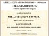
The handwritten “Drawing Book of Siberia” (–) is the first Russian geographical atlas that summarized the results of geographical discoveries of the 17th century. In 1695 S.U. Remezov made copies of maps sent to Moscow from Siberia and created a number of original drawings. In 1696–97, drawings of different parts of Siberia were drawn up in Tobolsk, Irkutsk and other cities. Remezov himself compiled the drawings of Western Siberia and the atlas of Siberian rivers. In 1699–1701, he and his three sons created the “Drawing Book of Siberia,” which consisted of a preface and 23 large-format maps covering the entire territory of Siberia and distinguished by the abundance and detail of information. The book's maps were made without a degree network and were oriented not to the north, but to the south. The atlas is distinguished by the abundance and detail of information and sums up the geographical materials accumulated by that time. The first edition of the atlas with a preface by Remezov himself was published by the Archaeographic Commission in 1882 in St. Petersburg.
The original “Drawing Book of Siberia” remained inaccessible to the general scientific community. To mark the 300th anniversary of the creation of the atlas, the directorate and research staff of the Russian State Library, together with specialists from the Federal Service of Geodesy and Cartography of Russia, decided to publish it in facsimile. To complete this project, it took about three years of work by a group of specialists - geographers, historians, artists and printers. Considerable amounts of money were also required.
By the end of 2003, the circulation of the two-volume edition of the “Drawing Book of Siberia” by S.U. Remezov was ready.
Service drawing book
The original “Service Drawing Book, written by Semyon Remezov with children” is kept in the manuscript department of the Russian National Library (Hermitage collection No. 237) and is a huge collection of maps and drawings, as well as sketches, projects and texts of an autobiographical nature, created at the end of the 17th - beginning of the 18th century It, like the Remezov Chronicle, was acquired by G.F. Miller and delivered to St. Petersburg. Initially, the materials were stored in the Hermitage Library, and then entered the Public Library (now the Russian National Library). This unique document was first published in its entirety in 2006. It contains enormous material on the history and geography of Siberia, the history of the construction of the Tobolsk Kremlin, as well as biographical information about the family of the authors of this work - the Remezovs.
The publication of the “Service Drawing Book” is a facsimile reproduction of a handwritten collection of service maps of Siberian lands and cities, drawings, plans, along with sketches, projects and texts of an autobiographical and preparatory nature. Each of the 154 articles in the manuscript is accompanied by illustrations. The facsimile edition is accompanied by translations of manuscripts into modern Russian, scientific reference apparatus and research carried out by Novosibirsk scientists E.I. Dergacheva-Skop and V.N. Alekseev.
The publication, thanks to the high level of printing, is an exemplary work of modern book art. Printed in Verona by Graphic (Italy).
Literature
- Goldenberg L. A. Semyon Ulyanovich Remezov. Siberian cartographer and geographer. 1642 - after 1720 - M.: Nauka, 1965. - 263 p.
- Kirillov V.V. Design methods of Semyon Remezov / Architectural Heritage. Vol. 22. Theoretical views and creative methods of the architects of the peoples of the USSR. Rep. ed. O. Kh. Khalpakhchyan, P. N. Maksimov. - M.: Stroyizdat, 1974. - 165 p.
- Martynov L. Son of a boyar / Similarities. M., Sovremennik, 1982.
- Innokenty Sokolov. Remezov, Semyon Ulyanovich // Russian Biographical Dictionary. St. Petersburg, 1913. - p. 48-50.
- V. K. Ziborov. Remezov Semyon Ulyanovich // Dictionary of scribes and bookishness of ancient Rus'. issue 3, part 3. St. Petersburg, 1988. - p. 195-196.
Notes
Links
- Chorographic book of Siberia in the collection of Harvard University Library
Russian encyclopedist of Siberia - cartographer, architect, builder, historian, artist, writer
Remezov entered the history of Russia primarily as a cartographer. He compiled three unique atlases - “Chorographic Book of Siberia”, “Drawing Book of Siberia” and “Service Book of Siberia”. All of them are the most valuable monuments of the Russian history of cartography.
Semyon Ulyanovich Remezov belonged to the service class of boyar children. Activities of S.U. Remezova is unusually diverse. He took part in repelling raids from the territory of modern Kazakhstan, in clashes with non-peaceful Vogulichs and Tatars, collected tribute, founded new villages, and conducted a population census. Remezov was the architect and construction manager of the only stone Kremlin in Siberia, in Tobolsk. He drew up drawings of the city's stone fortifications, calculated estimates for the work and supervised the construction, which began in 1697. Along the way, he searched for lime, ensured the extraction of clay, the construction of brick kilns and their production, was responsible for the supply of workers, the supply of wooden piles, looked for sand and rubble stone.
According to Remezov’s drawings, not only the Tobolsk Kremlin was built, but also the most important administrative buildings of the city: the Prikaznaya Chamber, the Gostiny Dvor; he also developed an exemplary design for a stone house for mass private development. In Tyumen, in the Trinity Monastery, the Peter and Paul Church was built according to Remezov’s design. He drew up not only plans for the state-owned Kamensk metallurgical plant, but also drawings of artillery pieces and cannonballs produced there. He was searching for saltpeter and creating a gunpowder factory.
He is the author of the works “On the borders and boundaries of all Siberia”, “Similarity of Siberian countries”, “Description of Siberia” and others. Historical-toponymic and ethnographic-geographical problems of the origin of the peoples of Siberia were considered by Remezov in “Description of the Siberian peoples and the facets of their lands” (1697–98). The events of the annexation of Siberia are described by him in the illustrated Remezov Chronicle, consisting of the “History of Siberia” (90s of the 17th century) and the “Short Chronicle of Siberia Kungur” (after 1703). In literature, the chronicle is known as the “Remezov Chronicle”, “Tobolsk Chronicle”, “Brief Siberian Chronicle”, “Kungur Chronicle”.)
Cause of death S.U. Remezov is unknown; most likely, as L. Martynov writes, he “burned out” at work.
Chorographic book of Siberia (1697–1711)
The history of this book is contradictory and in many ways unclear - although the book is dedicated to Peter I, it was not given to him. In Russia it is almost unknown. The original “Chorographic Book” was discovered in the archive of ancient acts of Russia only at the beginning of the 20th century. For many years the book was considered lost, but in 1958 the manuscript appeared in the form of a phototype edition (Atlas of Siberia, Amsterdam, black and white, prepared for publication by L.S. Bagrov) - the original atlas, taken out (actually stolen) by the historian L.S. . Bagrov from Russia in 1918, from 1956 to the present day kept in the Houghton Library at Harvard University.
Since the mid-1990s Researchers are increasingly turning to individual sheets of the “Chorographic Book”, which contain the most valuable information on cartography, history, archeology and ethnography of the population of Siberia. The special attention of ethnographers and archaeologists to the first atlas of Siberia is due primarily to the fact that the “Chorographic Drawing Book” to a certain extent serves as a more complete source than some of the drawings of Remezov’s two other atlases, since not all the important information contained in its drawings is produced on a larger scale, fit into their small-scale maps. They also lack individual drawings, which are available only in the “Chorographic Drawing Book”.
After twelve years of negotiations with the Harvard University Library, the Tobolsk Revival public foundation managed to obtain consent to restore and scan the manuscript of S.U. Remezov for subsequent publication. This was not cheap, but in 2011, 300 years after its creation, in Russia, this unique atlas finally became available to a wide range of specialists and scientists, as well as history buffs. The circulation of the publication is only 600 copies. The “Chorographic Drawing Book of Siberia” is transferred to the libraries of the largest cultural and scientific centers of Russia.
Remezov, Semyon Ulyanovich(1642 - after 1720), outstanding cartographer, architect, historian. Information on the biographical nature of the Ishim Cossack, then the Tobolsk son of a boyar and, finally, the choice of a nobleman is sufficiently presented only for the heyday of his versatile activities - for the period 1690-1710. (the expression “son of a boyar” does not mean class origin, but corresponds to the most junior position in the civil service).
Being under the Tobolsk administration since the 1680s. and while engaged in the construction of new settlements, Remezov traveled practically throughout Western Siberia, drawing up many geographical drawings and reports with descriptions of the area. The most complete cartographic heritage of Remezov has been preserved in the form of his three handwritten drawing books: “Drawing Book of Siberia” (contains 23 drawings, stored in the Russian State Library), “Service Drawing Book” (contains 50 drawings, stored in the Russian National Library) and “Chorographic Drawing Book” ( 164 drawings, stored in the USA). The likely result of the Russian legislative act of 1696 (Complete collection of laws of the Russian Empire, vol. 3, no. 1532) “On making a drawing of Siberia on canvas showing cities, villages, peoples and distances between tracts” is his huge cartographic work (213x277 cm), made on fabric in 1699, “Drawing of all Siberian cities and lands”, is now on permanent display at the State Hermitage. Some archives contain several more single drawings on paper of his work, for example, drawings of rivers in the fund 192 of the RGADA. Although the title page of Remezov’s first atlas, dated January 1, 1701, emphasizes that it was compiled by decree of Tsar Peter Alekseevich (this decree has not been published and has not yet been discovered), the author’s relationship with the government administration was not easy, which is why The date of his death is unknown to us. The nature of Remezov’s cartographic style is unique; he found himself at the junction of two “cartographic” eras - traditional, national and new, Western European. His works reflect the short period of transition of Russian cartography from scale-free Russian drawings to a strictly metric image of the earth's surface according to strict mathematical design rules, indicating azimuthal orientation and the presence of a coordinate grid. There are no scale relationships in the modern sense in Remezov’s drawings, although many have an image of a rectangular grid and a frame with a regular layout, but without digital designations of latitudes and longitudes, and some even have an image of a linear scale with the inscription “billion”.
Remezov's cartographic heritage is entirely devoted to mapping the lands of Siberia; in mathematical and cartographic terms, it can be divided into four parts (significantly different in the number of monuments). The first section is drawings of the whole of Siberia, a similar scale of about 1: 10 million, the second section is drawings of urban lands, their similar scale can be estimated at about 1:500 thousand. The third section is strip drawings of rivers, a similar scale of about 1:100 thousand. The fourth and last section is the largest-scale images (about 1:3 thousand), there are very few of them, almost all the drawings in this group are images of Tobolsk alone. However, even such a large scale does not always make it possible to fully depict the internal development of a medieval city; the author himself, one might say, disclaims responsibility for the lack of 100% completeness of the display with a brief note: “it is impossible to describe all the cross streets and alleys for the sake of inconvenience.”
When creating drawings of the second group - images of lands administratively subordinate to a city, which is, as a rule, located approximately in the center of this territory, Remezov uses a unique cartographic technique of “scale accent”. Although the concept of “scale” can only be attributed to Remezov’s drawings only conditionally, approximately, in almost all the drawings of this group (a similar scale is about 1:500 thousand) the cities themselves are shown 10-15 times larger, which allows you to see the nature of the development, the main structures, number of towers and other details.
Obviously, the oldest “by age”, the most ancient cartographic work among all Remezov’s drawings is “Drawing and similarity of the presence of the lands of all Siberia of the Tobolsk city and all the rose cities and dwellings and steppes”, compiled in 1673 with the participation of Metropolitan of Siberia and Tobolsk Cornelius “according to interrogations, verbatim and hospitably, testing the leaders, experienced and old-timers about everything.” Some researchers call this drawing the first Russian thematic map - a map of the national composition of the population. Another circumstance also attracts attention - here for the first time on a Russian geographical drawing there are two toponyms of Western European origin. Why Remezov used the inscriptions “Great Tartary” and “Great Muscovy” here remains a mystery.
The “Service Drawing Book”, stored in St. Petersburg, is somewhat different from other Remezov atlases in content and time of creation (1702-1730). Obviously, some of the drawings were drawn up by Remezov’s sons and students. In this book, not only are the geographical boundaries significantly expanded - in addition to Siberia, Kamchatka, the lands of the “Kingdom of China, the Khin Lordship, Tartary or the Great Khan Lordship” appear, but the purely cartographic side of the atlas is also expanded. The range of scales is wider, and the subject matter is wider, from copies-reconstructions of old maps and historical maps (for example, “Drawing of the victory of King Kuchum”) to images of “taurs” - petroglyphs of unknown peoples. For the first time in Russian there is a map with lines of meridians and parallels - a map of Siberia by A.A. Vinius. Remezov’s last atlas, “Chorographic Drawing Book,” was compiled in 1697-1711. (since the 1920s, belongs to Harvard University). In this atlas, while maintaining his graphic style, Remezov significantly expands the text part, adding several articles of a theoretical and worldview nature to the geographical descriptions of the territories. The beginnings of astronomy and geography are outlined, diagrams of a compass, compass, graphic scale, a table of symbols are given, clear definitions are given to a number of terms (for example, “chorography is a description of a large part of the Earth”, “a compass is a womb, a fishing route for footmen and seamen”, “ The sun is the measure of the days of life.
The RGADA houses several Russian reographic drawings, undoubtedly the hands of S.U. Remezov, in particular: “Drawing of part of the Irtysh”, “Drawing of the Vagai River from the mouth to the top” and “Drawing of the Tobol River from the mouth to the top”. These individual drawings of rivers, like those included in the “Chorographic Book,” can be called “ribbon” maps. By laying the river bed on a narrow long paper strip (for example, the size of the “Drawing of the Tobol River” is 32x507 cm), the author is forced to “straighten” its large bends, disrupt the actual geometric shapes, at the same time, the sequence of tributaries, the relative position of settlements and other objects relative to the coastal The features are drawn correctly.
A huge array of collected historical information about the territories being mapped allowed Remezov to create independent works on the history of the region. Four handwritten books by Remezov have been preserved, the contents of which are entirely devoted to Siberia: these are “Siberian History” (compiled in 1697 -1698), “Siberian Brief Kungur Chronicle” (1709-1710), “Description of the Siberian Peoples and the Facets of Their Lands” (1697 -1698), in 1964, the “Remezov chronograph” (circa 1690) was discovered in Tobolsk. A distinctive feature of Remezov’s chronicle works is their rich saturation with miniature drawings. In 1880, the Kungur Chronicle was published in St. Petersburg with a facsimile reproduction of its 154 illustrations.
.
As a striking example, let us give a photograph of a tablet placed in the local history museum of the city of Khabarovsk under an old map from the “Drawing Book of Siberia” by S.U. Remezov, Fig. 11.65. Photo kindly provided to us by G.A. Khrustalev:
Fig. 11.65
Semyon Ulyanovich Remezov is a Russian cartographer and historian of the 17th century. His geographical atlas of 23 maps "Drawing Book of Siberia" dates from 1699-1701, p. 1114. The museum plaque, Fig. 11.65, states that on the map of S.U. Remezov<<в устье Амура дано обозначение города с башнями и колоколами, а также подпись: "ДО СЕГО МЕСТА ЦАРЬ АЛЕКСАНДР МАКЕДОНСКИЙ ДОХОДИЛ И РУЖЬЕ СПРЯТАЛ И КОЛОКОЛА ОСТАВИЛ">>. By “gun,” most likely, they meant guns, weapons in general.
Then we managed to find this map of Remezov itself in an excellent facsimile edition of his Atlas.
This is what the indicated inscription on the map looks like, Fig. 11.65a, Fig. 11.65b.
Spread of a book with a map >>
Fig.11.65b. Enlarged selected fragment of the map with the inscription: 
From a modern point of view, this old inscription sounds wild. There is no other way to say it. After all, the campaign of the “ancient” Alexander the Great at the mouth of the distant taiga Amur is out of the question in Scaligerian history. Especially with guns and bells. A modern historian will condescendingly say: what to take from the uneducated Remezov. He didn't know the correct story. True, he somehow managed to compile a wonderful atlas of Siberia. But at the same time he “fantasized incorrectly.” One should not take his “historical fantasies” seriously.
However, in our reconstruction, Remezov’s information is quite meaningful and plausible. Since Tsar Alexander the Great (partially Suleiman the Magnificent) lived in the 15th-16th centuries, during the era of the great Ottoman = Ataman conquest. The waves of which reached the Far East. Including to China and Japan. As a result, samurai = Samarians = Samaritans appeared in Japan. See the book "Biblical Rus'".
Regarding Remezov’s map, we note an interesting circumstance. This map (based, perhaps, on some earlier “Mongolian” map) hung on the wall of the Ekateringof Palace in St. Petersburg. This is what the 19th century historian M.I. Pylyaev reports.<<На лестнице, ведущей на нижний этаж, на стене, вместо обоев, висит большая на холсте карта Азиатской России. КАРТА НАПИСАНА ВИДИМО ДЛЯ ШУТКИ: вряд ли найдутся реки в учебниках с такими названиями, как здесь; на карте также и страны света поменялись местами: вверху море Индейское и Песчаное, внизу север и Ледовитое море, Акиан (sic!), к западу Камчатка и царство Гилянское на берегу реки Амура, С КУРЬЕЗНОЙ НАДПИСЬЮ: "до сего места Александр Македонский доходил, ружье спрятал, колокол оставил". По преданию, по этой карте Петр экзаменовал ради смеха нетвердо знающих географию>> , p.82.
Thus, in the time of Peter, the map, which preserved traces of the former geography and names of the Asian part of the Great = "Mongol" Empire, was still in the palace. But, having already been brought up on the “new” Scaligerian-Millerian history, Peter and his courtiers treated the map only as a curiosity. The 19th century historian M.I. Pylyaev jokes about it in exactly the same way. Not suspecting that, most likely, this map corresponded better to reality than the Scaligerian geography introduced into the minds not so long ago. Today, Remezov’s map “Drawing of the Greater Entire Siberia” is sometimes exhibited in the Petrovskaya Gallery of the State Hermitage in St. Petersburg, p.24.
Lit.: Drawing book of Siberia, compiled by the Tobolsk boyar son Semyon Remezov in 1701, St. Petersburg, 1882; Goldenberg L. A., Semyon Ulyanovich Remezov - Siberian cartographer and geographer, M., 1965:
“The Drawing Book of Siberia” by Semyon Remezov and his three sons can easily be called the first Russian geographical atlas. It consists of a preface and 23 large-format maps, covering the entire territory of Siberia and distinguished by the abundance and detail of information. The book presents handwritten drawings of the lands: Tobolsk City and towns with streets, Tobolsk city, Tara city, Tyumen city, Turin fort, Vekhotursky city, Pelymsky city, and other cities and surrounding areas.
DRAWING BOOK OF SIBERIA"
first Russian geographical an atlas that summarized the results of geographical discoveries of the 17th century. 10 Jan 1696 By the Siberian Order, royal letters were sent to all cities of Siberia on the drawing up of detailed drawings covering the explored territory. edges. In 1696-97, in Tobolsk, Irkutsk and other cities, drawings of various cities and districts of Siberia were drawn up. Drawings Zap. Siberia and atlas of Siberian rivers, so-called. The “Chorographic Book” was compiled by S. U. Remezov (170 pages, stored in Stockholm).
In the fall of 1695, Remezov, while in Moscow, created a number of drawings and made copies of maps sent there from Siberia. In 1699-1701, Remezov, together with his sons Semyon, Leonty and Ivan, created the “Ch.K.S.” in Tobolsk. It was made on 24 sheets and contained a Preface (“Scripture for the gentle reader”) and 23 maps: a drawing of Tobolsk, 18 drawings of counties covering the entire territory. Siberia, drawing of the Mongolian "waterless and impassable stone steppe", general drawing of Siberia, drawing of the north of Europe. parts of Russia, ethnographic. map of Siberia. "Ch.k.S." didn't have a math degree. foundations, was made without a degree network and was oriented not to the north, but to the south. Despite this, “Ch.k.S.” I imagined. achievement of early Russian cartography. The original "Ch.K.S." stored in Moscow in the State. library named after V.I. Lenin.