Relief of the East European (Russian) Plain
The East European (Russian) Plain is one of the largest plains in the world by area. Among all the plains of our Motherland, only it opens to two oceans. Russia is located in the central and eastern parts of the plain. It extends from the coast of the Baltic Sea to the Ural Mountains, from the Barents and White Seas to the Azov and Caspian Seas.
The East European Plain has the highest density of rural population, large cities and many small towns and urban-type settlements, and a variety of natural resources. The plain has long been developed by man.
The rationale for its definition as a physical-geographical country is the following: 1) an elevated strata plain formed on the plate of the ancient East European Platform; 2) Atlantic-continental, predominantly moderate and insufficiently humid climate, formed largely under the influence of the Atlantic and Arctic oceans; 3) clearly defined natural zones, the structure of which was greatly influenced by the flat terrain and neighboring territories - Central Europe, Northern and Central Asia. This led to the interpenetration of European and Asian species of plants and animals, as well as to a deviation from the latitudinal position of natural zones in the east to the north.
Relief and geological structure
The East European Elevated Plain consists of hills with heights of 200-300 m above sea level and lowlands along which large rivers flow. The average height of the plain is 170 m, and the highest - 479 m - is on the Bugulminsko-Belebeevskaya Upland in the Ural part. The maximum elevation of the Timan Ridge is somewhat lower (471 m).
According to the characteristics of the orographic pattern within the East European Plain, three stripes are clearly distinguished: central, northern and southern. A strip of alternating large uplands and lowlands passes through the central part of the plain: the Central Russian, Volga, Bugulminsko-Belebeevskaya uplands and General Syrt are separated by the Oka-Don lowland and the Low Trans-Volga region, along which the Don and Volga rivers flow, carrying their waters to the south.
To the north of this strip, low plains predominate, on the surface of which smaller hills are scattered here and there in garlands and singly. From west to east-northeast, the Smolensk-Moscow, Valdai Uplands and Northern Uvals stretch here, replacing each other. They mainly pass through the watersheds between the Arctic, Atlantic and internal (drainless Aral-Caspian) basins. From the Northern Uvals the territory descends to the White and Barents Seas. This part of the Russian Plain A.A. Borzov called it northern slope. Large rivers flow along it - Onega, Northern Dvina, Pechora with numerous high-water tributaries.
The southern part of the East European Plain is occupied by lowlands, of which only the Caspian is located on Russian territory.
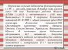
Figure 1 – Geological profiles across the Russian Plain
The East European Plain has a typical platform topography, which is predetermined by the tectonic features of the platform: the heterogeneity of its structure (the presence of deep faults, ring structures, aulacogens, anteclises, syneclises and other smaller structures) with the unequal manifestation of recent tectonic movements.
Almost all large hills and lowlands of the plain are of tectonic origin, with a significant part inherited from the structure of the crystalline basement. In the process of a long and complex development path, they formed as a single territory in morphostructural, orographic and genetic terms.
At the base of the East European Plain lie the Russian plate with a Precambrian crystalline foundation and in the south the northern edge of the Scythian plate with a Paleozoic folded foundation. The boundary between the plates is not expressed in the relief. On the uneven surface of the Precambrian foundation of the Russian plate there are strata of Precambrian (Vendian, in places Riphean) and Phanerozoic sedimentary rocks with weakly disturbed occurrence. Their thickness is not the same and is due to the unevenness of the foundation relief (Fig. 1), which determines the main geostructures of the plate. These include syneclises - areas of deep foundation (Moscow, Pechora, Caspian, Glazov), anteclises - areas of shallow foundation (Voronezh, Volga-Ural), aulacogens - deep tectonic ditches, in the place of which syneclises subsequently arose (Kresttsovsky, Soligalichsky, Moskovsky, etc.), protrusions of the Baikal foundation - Timan.
The Moscow syneclise is one of the oldest and most complex internal structures of the Russian plate with a deep crystalline foundation. It is based on the Central Russian and Moscow aulacogens, filled with thick Riphean strata, above which lies the sedimentary cover of the Vendian and Phanerozoic (from Cambrian to Cretaceous). In the Neogene-Quaternary time, it experienced uneven uplifts and is expressed in relief by fairly large elevations - Valdai, Smolensk-Moscow and lowlands - Upper Volga, North Dvina.
The Pechora syneclise is located wedge-shaped in the northeast of the Russian Plate, between the Timan Ridge and the Urals. Its uneven block foundation is lowered to varying depths - up to 5000-6000 m in the east. The syneclise is filled with a thick layer of Paleozoic rocks, overlain by Meso-Cenozoic deposits. In its northeastern part there is the Usinsky (Bolshezemelsky) arch.
In the center of the Russian plate there are two large anteclises - the Voronezh and Volga-Urals, separated by the Pachelma aulacogen. The Voronezh anteclise gently descends to the north into the Moscow syneclise. The surface of its basement is covered with thin sediments of the Ordovician, Devonian and Carboniferous. Carboniferous, Cretaceous and Paleogene rocks occur on the southern steep slope. The Volga-Ural anteclise consists of large uplifts (vaults) and depressions (aulacogens), on the slopes of which flexures are located. The thickness of the sedimentary cover here is at least 800 m within the highest arches (Tokmovsky).
The Caspian marginal syneclise is a vast area of deep (up to 18-20 km) subsidence of the crystalline basement and belongs to the structures of ancient origin; the syneclise is limited on almost all sides by flexures and faults and has angular outlines. From the west it is framed by the Ergeninskaya and Volgograd flexures, from the north by the flexures of General Syrt. In places they are complicated by young faults. In Neogene-Quaternary time, further subsidence (up to 500 m) and accumulation of a thick layer of marine and continental sediments occurred. These processes are combined with fluctuations in the level of the Caspian Sea.
The southern part of the East European Plain is located on the Scythian epi-Hercynian plate, lying between the southern edge of the Russian plate and the alpine folded structures of the Caucasus.
Tectonic movements of the Urals and the Caucasus led to some disruption of the sedimentary deposits of the plates. This is expressed in the form of dome-shaped uplifts, significant swells (Oka-Tsniksky, Zhigulevsky, Vyatsky, etc.), individual flexural bends of layers, salt domes, which are clearly visible in the modern relief. Ancient and young deep faults, as well as ring structures, determined the block structure of plates, the direction of river valleys and the activity of neotectonic movements. The predominant direction of the faults is northwestern.
A brief description of the tectonics of the East European Plain and a comparison of the tectonic map with the hypsometric and neotectonic ones allows us to conclude that the modern relief, which has undergone a long and complex history, is in most cases inherited and dependent on the nature of the ancient structure and manifestations of neotectonic movements.
Neotectonic movements on the East European Plain manifested themselves with different intensity and direction: in most of the territory they are expressed by weak and moderate uplifts, weak mobility, and the Caspian and Pechora lowlands experience weak subsidence.
The development of the morphostructure of the northwestern plain is associated with the movements of the marginal part of the Baltic shield and the Moscow syneclise, therefore monoclinal (sloping) strata plains are developed here, expressed in orography in the form of hills (Valdai, Smolensk-Moscow, Belorussian, Northern Uvaly, etc.), and strata plains occupying a lower position (Verkhnevolzhskaya, Meshcherskaya). The central part of the Russian Plain was influenced by intense uplifts of the Voronezh and Volga-Ural anteclises, as well as subsidence of neighboring aulacogens and troughs. These processes contributed to the formation of layered, stepwise uplands (Central Russian and Volga) and the layered Oka-Don plain. The eastern part developed in connection with the movements of the Urals and the edge of the Russian plate, so a mosaic of morphostructures is observed here. In the north and south, accumulative lowlands of the marginal syneclises of the plate (Pechora and Caspian) are developed. Between them alternate stratified-tiered uplands (Bugulminsko-Belebeevskaya, Obshchiy Syrt), monoclinal-stratified uplands (Verkhnekamskaya) and the intraplatform folded Timan Ridge.
During the Quaternary, climate cooling in the northern hemisphere contributed to the spread of glaciation. Glaciers had a significant impact on the formation of relief, Quaternary deposits, permafrost, as well as on changes in natural zones - their position, floristic composition, wildlife and the migration of plants and animals within the East European Plain.
There are three glaciations on the East European Plain: Oka, Dnieper with the Moscow stage and Valdai. Glaciers and fluvioglacial waters created two types of plains - moraine and outwash. In the wide periglacial (pre-glacial) zone, permafrost processes dominated for a long time. Snowfields had a particularly intense impact on the relief during the period of reduced glaciation.
The moraine of the most ancient glaciation - the Oka - was studied on the Oka, 80 km south of Kaluga. The lower, heavily washed Oka moraine with Karelian crystalline boulders is separated from the overlying Dnieper moraine by typical interglacial deposits. In a number of other sections to the north of this section, under the Dnieper moraine, the Oka moraine was also discovered.
Obviously, the moraine relief that arose during the Oka Ice Age has not been preserved to this day, since it was first washed away by the waters of the Dnieper (Middle Pleistocene) glacier, and then it was covered by its bottom moraine.
The southern border of the maximum distribution of the Dnieper cover glaciation crossed the Central Russian Upland in the Tula region, then descended along the Don valley - to the mouth of the Khopr and Medveditsa, crossed the Volga Upland, then the Volga near the mouth of the Sura River, then went to the upper reaches of the Vyatka and Kama and crossed the Urals in area 60° N. In the Upper Volga basin (in Chukhloma and Galich), as well as in the Upper Dnieper basin, above the Dnieper moraine lies the upper moraine, which is attributed to the Moscow stage of the Dnieper glaciation*.
Before the last Valdai glaciation in the interglacial era, the vegetation of the middle zone of the East European Plain had a more thermophilic composition than the modern one. This indicates the complete disappearance of its glaciers in the north. During the interglacial era, peat bogs with brazenia flora were deposited in lake basins that arose in depressions of the moraine relief.
In the north of the East European Plain, boreal ingression arose during this era, the level of which was 70-80 m above modern sea level. The sea penetrated through the valleys of the Northern Dvina, Mezen, and Pechora rivers, creating wide branching bays. Then came the Valdai glaciation. The edge of the Valdai ice sheet was located 60 km north of Minsk and went northeast, reaching Nyandoma.
Changes occurred in the climate of more southern regions due to glaciation. At this time, in the more southern regions of the East European Plain, the remnants of seasonal snow cover and snow patches contributed to the intensive development of nivation, solifluction, and the formation of asymmetric slopes near erosive landforms (ravines, gullies, etc.).
Thus, if ice existed within the distribution of the Valdai glaciation, then nival relief and sediments (boulder-free loams) were formed in the periglacial zone. The non-glacial, southern parts of the plain are covered by thick layers of loess and loess-like loams, synchronous with the ice ages. At this time, due to climate humidification, which caused glaciation, and also, possibly, with neotectonic movements, marine transgressions occurred in the Caspian Sea basin.
Natural processes of the Neogene-Quaternary time and modern climatic conditions on the territory of the East European Plain determined various types of morphosculptures, which are zonal in their distribution: on the coast of the seas of the Arctic Ocean, marine and moraine plains with cryogenic relief forms are common. To the south lie moraine plains, transformed at various stages by erosion and periglacial processes. Along the southern periphery of the Moscow glaciation there is a strip of outwash plains, interrupted by remnant elevated plains covered with loess-like loams, dissected by ravines and ravines. To the south there is a strip of fluvial ancient and modern landforms on highlands and lowlands. On the coast of the Azov and Caspian Seas there are Neogene-Quaternary plains with erosional, depression-subsidence and aeolian relief.
The long geological history of the largest geostructure - the ancient platform - predetermined the accumulation of various minerals on the East European Plain. The richest deposits of iron ore are concentrated in the foundation of the platform (Kursk Magnetic Anomaly). Associated with the sedimentary cover of the platform are deposits of coal (eastern part of Donbass, Moscow basin), oil and gas in Paleozoic and Mesozoic deposits (Ural-Volga basin), and oil shale (near Syzran). Building materials (songs, gravel, clays, limestones) are widely used. Brown iron ores (near Lipetsk), bauxites (near Tikhvin), phosphorites (in a number of areas) and salts (Caspian region) are also associated with the sedimentary cover.
It would seem that all the processes of forming the Earth’s landscapes have long been completed: the planet has high mountains and deep depressions, plains, lowlands, and hills. However, even today there is a continuous development of landforms. Under the influence of internal and external forces, the external appearance of the globe continues to undergo changes.
Relief formation
Modern relief is changing all the time: there is a continuous process of destruction, movement and accumulation of rocks, leading to the formation of new forms of landscape.
All processes influencing the formation of relief are divided into two large groups: internal (endogenous) and external (exogenous).
Endogenous processes are the latest tectonic processes occurring in the bowels of the earth. They appear equally in the mountains and on the plains.
Where the earth's crust, due to its antiquity, has lost its former plasticity, the rocks can no longer bend in the form of folds. As a result, under the influence of tectonic movements, powerful faults and faults are formed, which dismember the land into huge blocks.
TOP 2 articleswho are reading along with this
An example of endogenous processes is the movement of rocks in the Caucasus, which occurs at a speed of up to 8 cm per year. In the Altai, Urals, and Sayan Mountains, neotectonic movements lead to the formation of faults: some blocks descend, others, on the contrary, rise.

Rice. 1. Caucasus Mountains.
Exogenous processes are processes occurring under the influence of wind, permafrost, and flowing water. External factors include:
- glaciation (lakes, “ram’s foreheads”, moraines);
- flowing waters (ravines, hollows, river valleys);
- wind (barchans, dunes);
- Human (waste heaps, quarries, tunnels).
Weathered rock contains a huge number of microorganisms. Together with roots, lichens, insect larvae and earthworms, they have a noticeable effect on the rock, gradually crushing and dissolving it. These processes are called biological weathering.

Rice. 2. Biological weathering.
Development of relief forms in Russia
The formation of relief on the territory of modern Russia dates back to the Quaternary period. At this time, the vast majority of land areas on the planet were covered with glaciers. The centers of glaciation were the Central Siberian Plateau, the Taimyr Peninsula and the present-day Ural Mountains.

Rice. 3. Taimyr Peninsula.
Over time, when glaciers began their gradual conquest of the south, layers of clay, rubble, and sand began to move after them. However, in the southern regions, under the influence of heat, glaciers began to quickly melt. This led to the subsidence of loose rocks and the formation of moraine relief. This type of relief prevails, for example, in the Smolensk and Moscow regions.
The water formed after the melting of glaciers filled the depressions in the rocks, which, in turn, led to the formation of lakes in the northern part of the Russian Plain.
one of the largest plains on our planet (second largest after the Amazon Plain in Western America). It is located in the eastern part. Since most of it is located within the borders of the Russian Federation, it is sometimes called Russian. In the northwestern part it is limited to the mountains of Scandinavia, in the southwestern part - and other mountains of central Europe, in the southeastern part -, and in the East -. From the north, the Russian Plain is washed by waters and, and from the south by, and.
The length of the plain from north to south is more than 2.5 thousand kilometers, and from west to east - 1 thousand kilometers. Almost the entire length of the East European Plain is dominated by gently sloping plains. Most of the country's major cities are located within the territory of the East European Plain. It was here that the Russian state was formed many centuries ago, which later became the largest country in the world by its territory. A significant part of Russia's natural resources is also concentrated here.
The East European Plain almost completely coincides with the East European Platform. This circumstance explains its flat terrain, as well as the absence of significant natural phenomena associated with movement (,). Small hilly areas within the East European Plain arose as a result of faults and other complex tectonic processes. The height of some hills and plateaus reaches 600-1000 meters. In ancient times, the shield of the East European Platform was at the center of glaciation, as evidenced by some landforms.

East European Plain. Satellite view
On the territory of the Russian Plain, platform deposits lie almost horizontally, making up lowlands and hills that form the surface topography. Where the folded foundation protrudes to the surface, hills and ridges are formed (for example, the Timan Ridge). On average, the height of the Russian Plain is about 170 meters above sea level. The lowest areas are on the Caspian coast (its level is approximately 30 meters below the level).
Glaciation left its mark on the formation of the relief of the East European Plain. This impact was most pronounced in the northern part of the plain. As a result of the passage of the glacier through this territory, many arose (Pskovskoe, Beloye and others). These are the consequences of one of the most recent glaciers. In the southern, southeastern and eastern parts, which were subject to glaciations in an earlier period, their consequences were smoothed out by processes. As a result of this, a number of hills (Smolensk-Moscow, Borisoglebskaya, Danilevskaya and others) and lake-glacial lowlands (Caspian, Pechora) were formed.
Even further south is a zone of hills and lowlands, elongated in the meridional direction. Among the hills one can note Priazovskaya, Central Russian, and Volga. Here they also alternate with plains: Meshcherskaya, Oksko-Donskaya, Ulyanovskaya and others.
Even further south are the coastal lowlands, which in ancient times were partially submerged under sea level. The flat relief here was partially corrected by water erosion and other processes, as a result of which the Black Sea and Caspian lowlands were formed.
As a result of the passage of the glacier through the territory of the East European Plain, valleys were formed, tectonic depressions expanded, and even some rocks were polished. Another example of the influence of the glacier is the winding deep peninsulas. When the glacier retreated, not only lakes formed, but also concave sandy depressions appeared. This happened as a result of the deposition of a large amount of sandy material. Thus, over many millennia, the multifaceted relief of the East European Plain was formed.


Russian Plain
On the East European Plain there are almost all types of natural zones found in Russia. Off the coast in
 Internal processes (endogenous) External processes (exogenous) Relief Mountains Plains high lowlands middle elevations low plateaus


 The Central Russian Upland is a hill in the center of the European part of Russia. It is located within the East European Plain - from the latitudinal section of the Oka River valley in the north to the Donetsk Ridge in the south. Length about 1000 km, width up to 500 km, height 200-250 m (maximum - 293 m); the southeastern part is called the Kalach Upland.
 The Smolensk-Moscow Upland stretches from southwest to northeast from the Belarusian city of Orsha to Yuryev. Polish. Consists of the Smolensk and Moscow uplands. It is about 500 km long, the highest point is 320 m (in the northeastern part of the Smolensk region). The relief is hilly, erosion-moraine.
 The Volga Upland is a hill on the right bank of the Volga from Nizhny Novgorod to Volgograd. Height up to 384 m. Predominant height 150-200 m. Width up to 500 km. The Volga Upland steeply, in places with ledges, breaks off towards the Volga and gently declines towards the Oka-Don lowland. It is strongly dissected by a gully-beam network. Individual parts of the high Volga slope are called mountains. The Volga Upland is characterized by the presence of tectonic swells and troughs that cause the development of structural forms of relief. It is composed of limestones, clays, sands, marls and other rocks.
 Severnye Uvaly is a hilly hill in the northern part of the East European Plain. Watershed of the Volga and Northern Dvina river basins Length about 600 km. The height is up to 293 m on “Isakova Mountain”, which is located near the village of Isakovo, Babushkinsky district, Vologda region.
 The Caucasus is a mountainous country located on the isthmus between the Black and Caspian seas and stretches for 1160 km. The Black and Azov Seas wash the Caucasus from the west, the Caspian Sea from the east. The northern border of the Caucasus is considered to be the Kuma-Manych depression, and the southern border is the state border of Azerbaijan, Armenia and Georgia with Turkey and Iran.
 The Ural Mountains are a mountain system between East European and Western. Siberian plains. The length is more than 2000 (with Pai-Khoi and Mugodzhary - more than 2500) km, width from 40 to 150 km.
 The Caspian lowland is a lowland located in the East. The European Plain in Russia and Kazakhstan surrounding the northern part of the Caspian Sea.
 The Timano Ridge is a hill located in the northeast of the East European Plain. It stretches from the Czech Bay of the Barents Sea to the southeast to the sources of the Vychegda River. The length of the ridge is about 900 km.
 Valdai Upland, Valdai is a hill in the northwestern part of the Russian Plain, within the Tver, Novgorod, Smolensk and partly Pskov and Leningrad regions, with a length of more than 600 km. Height from 150 to 250 m, highest point - 346.9 m. Tourism area. On the hill are the Valdai and Sebezhsky national parks, Rdeysky and Polistovsky nature reserves.

 The North Siberian (Taimyr) lowland is a lowland in Russia, in the northern part of Eastern Siberia, in the Taimyr region of the Krasnoyarsk Territory and Yakutia. With a width of about 600 km, it extends for 1.4 thousand km between the mouth sections of the Yenisei and Olenyok rivers. It is characterized by a gently undulating topography with heights of up to 300 meters. The North Siberian Lowland is composed of marine and glacial sediments, sandstones and shales. On its territory there are deposits of oil, natural gas, and coal.
 The Yana-Indigirka Lowland stretches for more than 600 km along the southern coast of the Laptev and Vostochno Seas. Siberian Sea, from Buor-Khaya Bay in the west to the river delta. Indigirka in the east. It also includes a vast river delta. Yana, hence the name, as well as the mouths of other, smaller rivers. It has the shape of a crescent, the width at its widest part reaches 300 km. The average height above the level is 30 -80 m. In some places, residual ridges of bedrock rise above the lowland, up to 558 m high
 The Kolyma Lowland is a low-lying plain located in the northeast of Yakutia in the basin of the Alazeya, Bolshaya Chukochya and left bank of the lower Kolyma rivers. Together with the Yana-Indigirka lowland, which lies to the west, it forms the vast East Siberian lowland. It is limited from the north by the East Siberian Sea, from the south by the Chersky Mountains, stretching for 750 km. From the west and east it is limited by the Alazeya and Yukagir plateaus.
 The Putora Plateau is a highly dissected mountain range located in the north-west of the Central Siberian Plateau. In the north and west, the plateau ends with a steep ledge (800 m or more), while the southern and eastern parts are characterized by gentle slopes. The maximum height of the plateau is 1701 m, among the highest peaks are Mount Kamen (1701 m), Kholokit (1542 m), Kotuyskaya (1510). In the north, the Putorana Plateau borders the Taimyr Peninsula. The name Putorana appeared on the map only in the post-war years and translated from Evenki means “lakes with steep banks.”
 Verkhoyansk Range (Verkhoyansk Mountain System) is a mountain system in Yakutia. The length is about 1200 km (from the Lena delta to the Tompo river). Width from 100 to 250 km. It consists of a number of ridges with alpine and smoothed relief (height up to 2389 m) and depressions separating them.
 The Chersky Ridge is located in the North. East of Siberia, but is not a ridge in the usual sense of the word, but is a mountain system extending over 1500 km. The highest point is Mount Pobeda, 3003 meters (according to outdated data 3147 meters).
 The Aldan Highland is a highland in Yakutia, located between the Olekma and Uchur rivers. The highest point is 2306 m. The highlands are composed mainly of gneisses and crystalline schists of the Aldan shield. Deposits of iron, copper, gold, coal and mica have been explored in the highlands. The relief of the highlands is dominated by flat interfluves up to 1000 m high, above which the Western Yangi, Sunnagyn, and Ket-Kap ranges rise. The slopes up to a height of 1200-1300 m are covered with larch taiga, which gives way to rocky tundra higher up.
 The Stanovoy Range (also known as the Outer Khingan) is a system of mountain ranges in the southern part of the Russian Far East, 700 km long from the middle reaches of the Olekma River to the sources of the Uchur River. In the west it connects with the Stanovoi Upland, in the east - with the Dzhugjur Mountains. It is the watershed of the rivers of the Arctic and Pacific oceans. Height up to 2412 m.
 The Sredinny Range is a mountain range, the main watershed ridge on the Kamchatka Peninsula. Length - 1200 km. It extends from north to south and contains a large number of volcanoes, mainly shield and stratovolcanoes. In addition to volcanoes, it consists of lava plateaus, individual mountain ranges and isolated peaks covered with glaciers (total area 866 km²). The Malkinsky, Kozyrevsky and Bystrinsky ridges stand out. The highest point is Ichinskaya Sopka (3621 m). Many volcanoes exceed 2000 m: Khuvkhoytun (2618 m), Alnai (2581 m), Shishel (2531 m), Ostraya Sopka (2539 m).
 Sikhote-Alin is a volcanic field of the Mesozoic folding region of the Pacific belt in the Far East of Russia in the Khabarovsk and Primorsky territories, which is the watershed of the rivers of the Amur basin, the Sea of Japan and the Tatar Strait. Length - 1200 km, width up to 250 km, maximum height 2090 m (Mount Tordoki-Yani)
 The Western Sayan is limited from the west by the Shapshalsky ridge of Eastern Altai and the Abakan ridge of the Kuznetsk Alatau. It stretches in a latitudinal direction in a strip gradually narrowing from 200 to 80 km, from the headwaters of the Abakan River to the junction with the Eastern Sayan ridges in the headwaters of the Kazyr, Uda and Kizhi-Khem rivers. The Minusinsk Basin adjoins the Western Sayan from the north, and the Tuva Basin from the south. The total length of the system is 650 km.
 Eastern Sayan is a mountain system with a length of over 1000 km in the southern part of Siberia in the south of the Krasnoyarsk Territory, the west of Buryatia, the Irkutsk region and the northeast of Tyva from the left bank of the Yenisei to the coast of Lake Baikal. Adjacent to the southwestern edge of the Siberian Platform. It has a folded structure of a northwestern and sublatitudinal direction. The main directions of the main ridges and chains coincide with the strike of tectonic structures and faults.
 The Altai Mountains represent a complex system of the highest ridges in Siberia, separated by deep river valleys and vast intramountain and intermountain basins. The mountain system is located where the borders of Russia, Mongolia, China and Kazakhstan meet. It is divided into Southern Altai (South-Western), South. Eastern Altai and Eastern Altai, Central Altai, Northern and North-Eastern Altai, North-Western Altai.
 The Stanovoe Highland is a mountain system in Transbaikalia on the territory of Buryatia, about 700 km long from the northern tip of Lake Baikal to the middle reaches of the Olekma River in the east-northeast direction. Includes the high mountain ranges of the South. Muisky, North Muisky, Kodar, Udokan, Kalarsky and large intermountain basins of the Baikal type at an altitude of 500-1000 m (Verkhneangarskaya, Muisko-Kuandinskaya, Verkhnecharskaya).
 Dzhugdzhu r - mountains in the Far East of Russia on the territory of the Khabarovsk Territory along the northwestern coast of the Sea of Okhotsk. The length is about 700 km, the maximum height is 1906 m (Mount Topko). They are the watershed of the Aldan basin and the Sea of Okhotsk.
 I blonovy ridge t (in Buryat: yabalgan-daban - “passable, passable pass”) is a mountain range with a predominance of mid-mountain relief in the central part of Transbaikalia, mainly in the territory of the Transbaikal Territory. The length of the ridge is 650 km, the maximum height is 1706 m (Kontalaksky Golets).
 Byrra Nga are mountains in the far north of Eastern Siberia, in the Krasnoyarsk Territory on the Taimyr Peninsula. The northernmost mountain system in Russia. The mountains are formed by a system of parallel or cone-shaped ridges (250-400 meters high) and vast undulating plateaus (up to 900 meters high). The ridges and plateaus are separated by rolling plains, through trough valleys and deep canyons. The mountains stretch for 1,100 kilometers from the Yenisei Bay of the Kara Sea in the southwest to the Laptev Sea in the northeast, with a width of up to 200 kilometers.


 The Chukotka Plateau is a system of medium-altitude ridges and massifs in the central part of the Chukotka Autonomous Okrug, in the northeastern part of the Russian Far East. It is part of the East Siberian Upland (German). Length about 450 km. The Chukotka Plateau extends from the Chaunskaya Bay to the Gulf of Anadyr. The highlands separate the basins of the Pacific and Arctic oceans.
 The Most-The Most - The longest chain of mountains in Russia - The highest mountains in Russia Ural Caucasus The youngest mountains in Russia Sredinny Range, Caucasus
 Lesson summary: Which landform is dominant? Plain. Where are the largest plains in Russia located? Why here? In the west of the country, east of the Urals. Platform areas of the earth's crust are located here. Where are the mountains located? Why in the south and east? Mainly in the south and southeast of the country. The boundaries of lithospheric plates pass here. Determine the overall slope. From south to north. The highest point in Russia is a mountain: Elbrus. The internal processes that form the relief are: Collision of lithospheric plates. Mountain structures correspond to: Folded areas.

 Homework: Practical work on a contour map: a) plains: Russian, West Siberian, Central Siberian Plateau, Caspian Lowland, North Siberian Lowland, Northern Uvaly, Valdai Upland, Volga Upland, Smolensk-Moscow Upland, Central Russian Upland, Kolyma Lowland, Yana-Indigirka lowland; b) mountains: Caucasus (Mt. Elbrus 5642 m), Ural (Mt. Narodnaya), Altai (Mt. Belukha), Sayan Mountains (Western and Eastern), Byrranga Mountains; ridges: Verkhoyansky, Chersky, Sikhote-Alin, Stanovoy, Dzhugdzhur, Sredinny, Yablonovy; highlands: Chukotka, Aldan, Stanovoe.