1. Deep structure of the Earth
The geographic envelope interacts, on the one hand, with the deep substance of the planet, and on the other, with the upper layers of the atmosphere. The deep structure of the Earth has a significant impact on the formation of the geographic envelope. The term “structure of the Earth” usually refers to its internal, i.e., deep structure, starting from the earth’s crust to the center of the planet.
The mass of the Earth is 5.98 x 10 27 g.
The average density of the Earth is 5.517 g/cm3.
Composition of the Earth. According to modern scientific ideas, the Earth consists of the following chemical elements: iron - 34.64%, oxygen - 29.53%, silicon - 15.20%, magnesium - 12.70%, nickel - 2.39%, sulfur - 1 .93%, chromium - 0.26%, manganese - 0.22%, cobalt - 0.13%, phosphorus - 0.10%, potassium - 0.07%, etc.
The most reliable data on the internal structure of the Earth comes from observations of seismic waves, that is, oscillatory movements of the earth's matter caused by earthquakes.
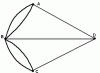
A sharp change in the speed of seismic waves (recorded on seismographs) at depths of 70 km and 2900 km reflects an abrupt increase in the density of matter at these limits. This gives grounds to isolate the following three shells (geospheres) in the inner body of the Earth: to a depth of 70 km - the earth's crust, from 70 km to 2,900 km - the mantle, and from there to the center of the Earth - the core. The nucleus is divided into an outer core and an inner core.
The Earth was formed about 5 billion years ago from some cold gas-dust nebula. After the mass of the planet reached its current value (5.98 x 10 27 g), its self-heating began. The main sources of heat were: firstly, gravitational compression, and secondly, radioactive decay. As a result of the development of these processes, the temperature inside the Earth began to increase, which led to the melting of metals. Since the matter was highly compressed in the center of the Earth and was cooled from the surface by radiation, melting occurred mainly at shallow depths. Thus, a molten layer was formed, from which silicate materials, being the lightest, rose upward, giving rise to the earth's crust. Metals remained at the melting level. Since their density is higher than that of undifferentiated deep substance, they gradually sank. This led to the formation of a metallic core.
The CORE is 85-90% iron. At a depth of 2,900 km (the boundary of the mantle and core), the substance is in a supersolid state due to enormous pressure (1,370,000 atm.). Scientists assume that the outer core is molten and the inner core is solid. The differentiation of earthly matter and the separation of the nucleus is the most powerful process on Earth and the main, first internal driving mechanism for the development of our planet.
The role of the nucleus in the formation of the Earth's magnetosphere. The core has a powerful effect on the formation of the Earth's magnetosphere, which protects life from harmful ultraviolet radiation. In the electrically conductive outer liquid core of a rapidly rotating planet, complex and intense movements of matter occur, leading to the excitation of a magnetic field. The magnetic field extends into near-Earth space over several Earth radii. Interacting with the solar wind, the geomagnetic field creates the Earth's magnetosphere. The upper boundary of the magnetosphere is at an altitude of about 90 thousand km. The formation of the magnetosphere and the isolation of the earth's nature from the plasma of the solar corona was the first and one of the most important conditions for the origin of life, the development of the biosphere and the formation of the geographical envelope.
THE MANTLE consists mainly of Mg, O, FeO and SiO2, which form magma. Magma contains water, chlorine, fluorine and other volatile substances. The process of differentiation of matter continuously occurs in the mantle. Substances lightened by the removal of metals rise towards the earth's crust, while heavier substances sink. Such movements of matter in the mantle are defined by the term “convection currents”.
The concept of the asthenosphere. The upper part of the mantle (within 100-150 km) is called the asthenosphere. In the asthenosphere, the combination of temperature and pressure is such that the substance is in a molten, mobile state. In the asthenosphere, not only constant convection currents occur, but also horizontal asthenospheric currents.
The speed of horizontal asthenospheric currents reaches only a few tens of centimeters per year. However, over geological time, these currents led to the splitting of the lithosphere into separate blocks and to their horizontal movement, known as continental drift. The asthenosphere contains volcanoes and earthquake centers. Scientists believe that geosynclines are formed above descending currents, and mid-ocean ridges and rift zones are formed above ascending currents.
2. The concept of the earth's crust. Hypotheses explaining the origin and development of the earth's crust
The Earth's crust is a complex of surface layers of the Earth's solid body. In the scientific geographical literature there is no single idea about the origin and paths of development of the earth's crust.
There are several hypotheses (theories) explaining the mechanism of formation and development of the earth's crust. The most reasonable hypotheses are the following:
- 1. The theory of fixism (from the Latin fixus - motionless, unchanging) states that the continents have always remained in the places that they currently occupy. This theory denies any movement of continents and large parts of the lithosphere (Charles Darwin, A. Wallace, etc.).
- 2. The theory of mobilism (from the Latin mobilis - mobile) proves that the blocks of the lithosphere are in constant motion. This concept has become especially firmly established in recent years in connection with the acquisition of new scientific data from the study of the bottom of the World Ocean.
- 3. The concept of continental growth at the expense of the ocean floor believes that the original continents formed in the form of relatively small massifs that now make up ancient continental platforms. Subsequently, these massifs grew due to the formation of mountains on the ocean floor adjacent to the edges of the original land cores. Study of the ocean floor, especially in the area of mid-ocean ridges, has given reason to doubt the correctness of this concept.
- 4. The theory of geosynclines states that the increase in land size occurs through the formation of mountains in geosynclines. The geosynclinal process, as one of the main ones in the development of the continental crust, forms the basis of many modern scientific explanations.
- 5. The rotation theory bases its explanation on the proposition that since the figure of the Earth does not coincide with the surface of a mathematical spheroid and is rearranged due to uneven rotation, the zonal stripes and meridional sectors on a rotating planet are inevitably tectonically unequal. They react with varying degrees of activity to tectonic stresses caused by intraterrestrial processes.
Oceanic and continental crust. There are two main types of earth's crust: oceanic and continental. Its transitional type is also distinguished.
Oceanic crust. The thickness of the oceanic crust in the modern geological era ranges from 5 to 10 km. It consists of the following three layers:
- 1) upper thin layer of marine sediments (thickness no more than 1 km);
- 2) middle basalt layer (thickness from 1.0 to 2.5 km);
- 3) lower layer of gabbro (thickness about 5 km).
Continental (continental) crust. The continental crust has a more complex structure and greater thickness than the oceanic crust. Its thickness averages 35-45 km, and in mountainous countries it increases to 70 km. It consists of the following three layers:
- 1) lower layer (basaltic), composed of basalts (thickness about 20 km);
- 2) middle layer (granite), formed mainly by granites and gneisses; forms the main thickness of the continental crust, does not extend under the oceans;
- 3) upper layer (sedimentary) about 3 km thick.
In some areas the thickness of precipitation reaches 10 km: for example, in the Caspian lowland. In some areas of the Earth there is no sedimentary layer at all and a layer of granite appears on the surface. Such areas are called shields (for example, Ukrainian Shield, Baltic Shield).
On continents, as a result of the weathering of rocks, a geological formation is formed, called the weathering crust.
The granite layer is separated from the basalt layer by the Conrad surface. At this boundary, the speed of seismic waves increases from 6.4 to 7.6 km/sec.
The boundary between the earth's crust and mantle (both on continents and oceans) runs along the surface of Mohorovicic (Moho line). The speed of seismic waves on it increases abruptly to 8 km/hour.
In addition to the two main types of the earth's crust (oceanic and continental), there are also areas of mixed (transitional) type.
On continental shoals or shelves, the crust is about 25 km thick and is generally similar to the continental crust. However, a layer of basalt may fall out. In East Asia, in the region of island arcs (Kuril Islands, Aleutian Islands, Japanese Islands, etc.), the earth's crust is of a transitional type. Finally, the crust of the mid-ocean ridges is very complex and has so far been little studied. There is no Moho boundary here, and mantle material rises along faults into the crust and even onto its surface.
The concept of "earth's crust" should be distinguished from the concept of "lithosphere". The concept of "lithosphere" is broader than the "earth's crust". In the lithosphere, modern science includes not only the earth’s crust, but also the uppermost mantle to the asthenosphere, that is, to a depth of about 100 km.
The concept of isostasy. A study of the distribution of gravity showed that all parts of the earth's crust - continents, mountainous countries, plains - are balanced on the upper mantle. This balanced position is called isostasy (from the Latin isoc - even, stasis - position). Isostatic equilibrium is achieved due to the fact that the thickness of the earth's crust is inversely proportional to its density. Heavy oceanic crust is thinner than lighter continental crust.
Isostasy is not even an equilibrium, but a desire for equilibrium, continuously disrupted and restored again. For example, the Baltic shield, after the melting of continental ice of the Pleistocene glaciation, rises by about 1 cm per year. The area of Finland is constantly increasing due to the seabed. The territory of the Netherlands, on the contrary, is decreasing. The zero equilibrium line currently runs slightly south of 600 N latitude. Modern St. Petersburg is approximately 1.5 m higher than St. Petersburg during the time of Peter the Great. As data from modern scientific research show, even the heaviness of large cities is sufficient for isostatic fluctuations of the territory beneath them. Therefore, the earth's crust in areas of large cities is very mobile. In general, the relief of the earth's crust is a mirror image of the Moho surface (the bottom of the earth's crust): elevated areas correspond to depressions in the mantle, lower areas correspond to a higher level of its upper boundary. Thus, under the Pamirs the depth of the Moho surface is 65 km, and in the Caspian lowland it is about 30 km.
Thermal properties of the earth's crust. Daily fluctuations in soil temperature extend to a depth of 1.0 - 1.5 m, and annual fluctuations in temperate latitudes in countries with a continental climate - to a depth of 20-30 m. At the depth where the influence of annual temperature fluctuations due to heating of the earth's surface by the Sun ceases , there is a layer of constant soil temperature. It is called an isothermal layer. Below the isothermal layer deep into the Earth, the temperature rises. But this increase in temperature is caused by the internal heat of the earth’s bowels. Internal heat practically does not participate in the formation of climates. However, it serves as the only energy basis for all tectonic processes.
The number of degrees by which the temperature increases for every 100 m of depth is called the geothermal gradient.
The distance in meters, when lowered by which the temperature increases by 10C, is called the geothermal step. The magnitude of the geothermal step depends on the topography, thermal conductivity of rocks, proximity of volcanic sources, circulation of groundwater, etc. On average, the geothermal step is 33 m. In volcanic areas, the geothermal step can be only 5 m, and in geologically quiet areas (on platforms) it can reach 100 m.
3. Structural-tectonic principle of separation of continents. The concept of continents and parts of the world
Two qualitatively different types of the earth's crust - continental and oceanic - correspond to two main levels of planetary relief - the surface of the continents and the bed of the oceans. The identification of continents in modern geography is carried out on the basis of the structural-tectonic principle.
Structural-tectonic principle of separation of continents.
The fundamentally qualitative difference between the continental and oceanic crust, as well as some significant differences in the structure of the upper mantle under the continents and oceans, oblige us to distinguish continents not according to their apparent surroundings by oceans, but according to the structural-tectonic principle.
The structural-tectonic principle states that, firstly, the continent includes a continental shelf (shelf) and a continental slope; secondly, at the base of every continent there is a core or ancient platform; thirdly, each continental block is isostatically balanced in the upper mantle.
From the point of view of the structural-tectonic principle, a continent is an isostatically balanced massif of the continental crust, which has a structural core in the form of an ancient platform, to which younger folded structures are adjacent.
There are six continents in total on Earth: Eurasia, Africa, North America, South America, Antarctica and Australia. Each continent contains one platform, and at the base of Eurasia alone there are six of them: Eastern European, Siberian, Chinese, Tarim (Western China, Taklamakan Desert), Arabian and Hindustan. The Arabian and Hindu platforms are parts of ancient Gondwana adjacent to Eurasia. Thus, Eurasia is a heterogeneous anomalous continent.
The boundaries between the continents are quite obvious. The border between North America and South America runs along the Panama Canal. The border between Eurasia and Africa is drawn along the Suez Canal. The Bering Strait separates Eurasia from North America.
Two rows of continents. In modern geography, the following two series of continents are distinguished:
- 1. Equatorial series of continents (Africa, Australia and South America).
- 2. Northern series of continents (Eurasia and North America).
Antarctica, the southernmost and coldest continent, remains outside these ranks.
The modern location of the continents reflects the long history of the development of the continental lithosphere.
The southern continents (Africa, South America, Australia and Antarctica) are parts (“fragments”) of the single Paleozoic megacontinent Gondwana. The northern continents at that time were united into another megacontinent - Laurasia. Between Laurasia and Gondwana in the Paleozoic and Mesozoic there was a system of vast marine basins called the Tethys Ocean. This ocean stretched from North Africa (through southern Europe, the Caucasus, Western Asia, the Himalayas to Indochina) to modern Indonesia. In the Neogene (about 20 million years ago), an Alpine fold belt arose in the place of this geosyncline.
According to its large size, the Gondwana supercontinent, according to the law of isostasy, had a thick (up to 50 km) crust, which was deeply buried in the mantle. Beneath this supercontinent, convection currents were especially intense in the asthenosphere; the softened substance of the mantle moved very actively. This led first to the formation of a bulge in the middle of the continent, and then to its split into separate blocks, which, under the influence of the same convection currents, began to move horizontally. It is known that the movement of a contour on the surface of a sphere is always accompanied by its rotation (Euler et al.). Therefore, parts of Gondwana not only moved, but also unfolded in geographical space.
The first breakup of Gondwana occurred at the Triassic-Jurassic boundary (about 190-195 million years ago); Afro-America seceded. Then, at the Jurassic-Cretaceous boundary (about 135-140 million years ago), South America separated from Africa. At the border of the Mesozoic and Cenozoic (about 65-70 million years ago), the Hindustan block collided with Asia, and Antarctica moved away from Australia. In the present geological era, the lithosphere, according to scientists, is divided into six plate blocks that continue to move.
The breakup of Gondwana successfully explains the shape, geological similarity, as well as the history of the vegetation and animal world of the southern continents. The history of the split of Laurasia has not been studied as thoroughly as Gondwana.
Patterns of the location of continents. The current location of the continents is characterized by the following patterns:
- 1. Most of the land is located in the Northern Hemisphere. The Northern Hemisphere is continental, although here only 39% is land and about 61% is ocean.
- 2. The northern continents are located quite compactly. The southern continents are located very scattered and disconnected.
- 3. The relief of the planet is anti-semitic. The continents are located in such a way that each of them on the opposite side of the Earth certainly has a corresponding ocean. This can best be seen by comparing the Arctic ocean and Antarctic land. If the globe is installed so that any of the continents is at one of the poles, then there will definitely be an ocean at the other pole. There is only one minor exception: the end of South America antipodal to Southeast Asia. Antipodality, since it has almost no exceptions, cannot be a random phenomenon. This phenomenon is based on the balance of all parts of the surface of the rotating Earth.
The concept of parts of the world. In addition to the geologically determined division of land into continents, there is also a division of the earth's surface into separate parts of the world that has developed in the process of cultural and historical development of mankind. There are six parts of the world in total: Europe, Asia, Africa, America, Australia and Oceania, Antarctica. On one continent of Eurasia there are two parts of the world (Europe and Asia), and two continents of the Western Hemisphere (North America and South America) form one part of the world - America.
The border between Europe and Asia is very arbitrary and is drawn along the watershed line of the Ural ridge, the Ural River, the northern part of the Caspian Sea and the Kuma-Manych depression. Deep fault lines that separate Europe from Asia run through the Urals and the Caucasus.
Area of continents and oceans. Land area is calculated within the modern coastline. The surface area of the globe is approximately 510.2 million km2. About 361.06 million km2 is occupied by the World Ocean, which is approximately 70.8% of the total surface of the Earth. The land area accounts for approximately 149.02 million km 2, i.e. about 29.2% of the surface of our planet.
The area of modern continents is characterized by the following values:
Eurasia - 53.45 km2, including Asia - 43.45 million km2, Europe - 10.0 million km2;
Africa - 30, 30 million km2;
North America - 24, 25 million km2;
South America - 18.28 million km2;
Antarctica - 13.97 million km2;
Australia - 7.70 million km2;
Australia with Oceania - 8.89 km2.
Modern oceans have an area of:
Pacific Ocean - 179.68 million km2;
Atlantic Ocean - 93.36 million km2;
Indian Ocean - 74.92 million km2;
Arctic Ocean - 13.10 million km2.
Between the northern and southern continents (according to their different origins and development) there is a significant difference in area and surface character. The main geographical differences between the northern and southern continents are as follows:
- 1. Eurasia is incomparable in size with other continents, containing more than 30% of the landmass of our planet.
- 2. The northern continents have a significant shelf area. The shelf is especially significant in the Arctic Ocean and the Atlantic Ocean, as well as in the Yellow, Chinese and Bering Seas of the Pacific Ocean. The southern continents, with the exception of the underwater continuation of Australia in the Arafura Sea, are almost devoid of a shelf.
- 3. Most of the southern continents lie on ancient platforms. In North America and Eurasia, ancient platforms occupy a smaller part of the total area, and most of them occur in areas formed by Paleozoic and Mesozoic orogeny. In Africa, about 96% of its territory is in platform areas and only 4% is in mountains of Paleozoic and Mesozoic age. In Asia, only 27% of the territory is occupied by ancient platforms and 77% by mountains of various ages.
- 4. The coastline of the southern continents, formed mostly by tectonic faults, is relatively straight; There are few peninsulas and mainland islands. The northern continents are characterized by an exceptionally winding coastline, an abundance of islands, peninsulas, often extending far into the ocean. Of the total area, islands and peninsulas account for about 39% in Europe, North America - 25%, Asia - 24%, Africa - 2.1%, South America - 1.1% and Australia (excluding Oceania) - 1.1% .
- 4. Vertical dissection of land
Each of the main planetary levels - the surface of the continents and the ocean floor - breaks down into a number of minor levels. The formation of both the main and minor levels occurred during the long-term development of the earth's crust and continues in the present geological time. Let us dwell on the modern division of the continental crust into high-altitude levels. The steps are counted from sea level.
- 1. Depressions are areas of land lying below sea level. The largest depression on Earth is the southern part of the Caspian lowland with a minimum elevation of -28 m. Inside Central Asia there is an extremely dry Turfan depression with a depth of about -154 m. The deepest depression on Earth is the Dead Sea basin; The shores of the Dead Sea lie 392 m below sea level. Depressions occupied by water, the levels of which lie above ocean level, are called cryptodepressions. Typical examples of cryptodepression are Lake Baikal and Lake Ladoga. The Caspian Sea and the Dead Sea are not cryptodepressions, because the water level in them does not reach ocean level. The area occupied by depressions (without cryptodepressions) is relatively small and amounts to about 800 thousand km2.
- 2. Lowlands (low plains) - areas of land lying at an altitude of 0 to 200 m above sea level. Lowlands are numerous on every continent (except Africa) and occupy a larger area than any other level of land. The total area of all the lowland plains of the globe is about 48.2 million km2.
- 3. Hills and plateaus lie at an altitude of 200 to 500 m and differ from each other in the prevailing forms of relief: on the hills the relief is rugged, on the plateau it is relatively flat. The hills rise above the lowlands gradually, and the plateau rises as a noticeable ledge. Hills and plateaus differ in each other and in their geological structure. The area occupied by hills and plateaus is about 33 million km2.
Above 500 m there are mountains. They can be of different origins and ages. By height, mountains are divided into low, medium and high.
- 4. Low mountains rise no higher than 1,000 m. Typically, low mountains are either ancient destroyed mountains or the foothills of modern mountain systems. Low mountains occupy about 27 million km2.
- 5. Medium mountains have a height of 1,000 to 2,000 m. Examples of medium-high mountains are: the Urals, the Carpathians, Transbaikalia, some ridges of Eastern Siberia and many other mountainous countries. The area occupied by medium-sized mountains is about 24 million km2.
- 6. High (alpine) mountains rise above 2,000 m. The term “alpine mountains” is often applied to only Cenozoic mountains lying at an altitude of more than 3,000 m. High mountains account for about 16 million km2.
Below ocean level, the continental lowland continues, flooded with water - the shelf, or continental shoal. Until recently, according to the same conventional account as the stages of land, the shelf was called underwater plains with depths of up to 200 m. Now the shelf boundary is drawn not along a formally chosen isobath, but along the line of the actual, geologically determined end of the continental surface and its transition to the continental slope . The shelf therefore continues into the ocean to different depths in each sea, often exceeding 200 m and reaching 700 and even 1,500 m.
At the outer edge of the relatively flat shelf there is a sharp break in the surface towards the continental slope and continental foot. The shelf, slope and foot together form the underwater margin of the continents. It continues to an average depth of 2,450 m.
Continents, including their underwater margins, occupy about 40% of the Earth's surface, while the land area is about 29.2% of the total earth's surface.
Each continent is isostatically balanced in the asthenosphere. There is a direct relationship between the area of the continents, the height of their relief and the depth of immersion in the mantle. The larger the area of the continent, the greater its average height and thickness of the lithosphere. The average height of the land is 870 m. The average height of Asia is 950 m, Europe - 300 m, Australia - 350 m.
The concept of a hypsometric (bathygraphic) curve. The generalized profile of the earth's surface is represented by a hypsometric curve. The part of it related to the ocean is called the bathygraphic curve. The curve is constructed as follows. The dimensions of areas lying at different heights and depths are taken from hypsometric and bathygraphic maps and plotted in a system of coordinate axes: heights are plotted along the ordinate line from 0 up, and depths down; along the abscissa - area in millions of square kilometers.
5. Relief and structure of the bottom of the World Ocean. Islands
The average depth of the World Ocean is 3,794 m.
The bottom of the World Ocean consists of the following four planetary morphosculptural forms:
- 1) underwater continental margins,
- 2) transition zones,
- 3) ocean bed,
- 4) mid-ocean ridges.
The underwater margin of continents consists of a shelf, a continental slope, and a continental foot. It descends to a depth of 2,450 m. The earth's crust here is of a continental type. The total area of the underwater continental margins is about 81.5 million km2.
The continental slope plunges into the ocean relatively steeply; the slopes average about 40, but sometimes they reach 400.
The continental foot is a trough at the boundary of the continental and oceanic crust. Morphologically, it is an accumulative plain formed by sediments carried down from the continental slope.
Mid-ocean ridges are a single and continuous system spanning all oceans. They are huge mountain structures, reaching a width of 1-2 thousand km and rising above the ocean floor by 3-4 thousand km. Sometimes mid-ocean ridges rise above ocean level and form numerous islands (Iceland, Azores, Seychelles, etc.). In terms of grandeur, they significantly surpass the mountainous countries of the continents and are comparable to the continents. For example, the Mid-Atlantic Ridge is several times larger than the largest land mountain system, the Cordillera and Andes. All mid-ocean ridges are characterized by increased tectonic activity.
The mid-ocean ridge system includes the following structures:
- - Mid-Atlantic Ridge (stretches from Iceland along the entire Atlantic Ocean to the island of Tristan da Cunha);
- - Mid-Indian Ridge (its peaks are expressed by the Seychelles Islands);
- - East Pacific Rise (extends south of the California Peninsula).
According to the relief and characteristics of tectonic activity, mid-ocean ridges are: 1) rift and 2) non-rift.
Rift ridges (for example, the Mid-Atlantic) are characterized by the presence of a “rift” valley - a deep and narrow gorge with steep slopes (the gorge runs along the crest of the ridge along its axis). The width of the rift valley is 20-30 km, and the depth of the fault can be located below the ocean floor up to 7,400 m (Romanche Trench). The relief of rift ridges is complex and rugged. All ridges of this type are characterized by rift valleys, narrow mountain ranges, giant transverse faults, intermontane depressions, volcanic cones, submarine volcanoes, and islands. All rift ridges are characterized by high seismic activity.
Non-rift ridges (for example, the East Pacific Rise) are characterized by the absence of a “rift” valley and have less complex terrain. Seismic activity is not typical for non-rift ridges. However, they share a common feature of all mid-ocean ridges - the presence of enormous transverse faults.
The most important geophysical features of mid-ocean ridges are as follows:
- -increased heat flow from the bowels of the Earth;
- -specific structure of the earth's crust;
- -magnetic field anomalies;
- -volcanism;
- -seismic activity.
The distribution of sediments that make up the upper layer of the earth's crust in mid-ocean ridges obeys the following pattern: on the ridge itself, sediments are thin or absent altogether; As one moves away from the ridge, the thickness of the sediments increases (up to several kilometers) and their age. If in the cleft itself the age of the lavas is approximately 13 thousand years, then 60 km away it is already 8 million years old. Rocks older than 160 million years have not been found at the bottom of the World Ocean. These facts indicate the constant renewal of mid-ocean ridges.
Mechanisms of formation of mid-ocean ridges. The formation of mid-ocean ridges is associated with upper magma. The upper magma is a huge convection system. According to scientists, the formation of mid-ocean ridges causes the Earth's interior to rise. Along rift valleys, lava flows out and forms a basalt layer. By joining the old crust, new portions of lava cause horizontal displacement of lithospheric blocks and expansion of the ocean floor. The speed of horizontal movements in different places of the Earth ranges from 1 to 12 cm per year: in the Atlantic Ocean - about 4 cm/year; in the Indian Ocean - about 6 cm/year, in the Pacific Ocean - up to 12 cm/year. These insignificant values, multiplied by millions of years, give enormous distances: in the 150 million years that have passed since the split of South America and Africa, these continents have diverged by 5 thousand km. North America separated from Europe 80 million years ago. And 40 million years ago, Hindustan collided with Asia and the formation of the Himalayas began.
As a result of the expansion of the ocean floor in the zone of mid-ocean ridges, there is not an increase in earthly matter at all, but only its flow and transformation. The basaltic crust, growing along the mid-ocean ridges and spreading horizontally from them, travels thousands of kilometers over the course of millions of years and, at some edges of the continents, descends again into the bowels of the Earth, taking with it ocean sediments. This process explains the different ages of rocks on the crests of ridges and in other parts of the oceans. This process also causes continental drift.
Transition zones include deep-sea trenches, island arcs, and basins of marginal seas. In transition zones, areas of continental and oceanic crust are complexly combined.
Deep ocean trenches are found in the following four regions of the Earth:
- - in the Pacific Ocean along the coast of East Asia and Oceania: Aleutian Trench, Kuril-Kamchatka Trench, Japanese Trench, Philippine Trench, Mariana Trench (with a maximum depth of 11,022 m for the Earth), Western Melanesian Trench, Tonga;
- - in the Indian Ocean - the Java Trench;
- - in the Atlantic Ocean - the Puerto Rican Trench;
- - in the Southern Ocean - South Sandwich.
The ocean floor, which accounts for about 73% of the total area of the World Ocean, is occupied by deep-water plains (from 2,450 to 6,000 m). In general, these deep-sea plains correspond to oceanic platforms. Between the plains there are mid-ocean ridges, as well as hills and uplifts of other origins. These rises divide the ocean floor into separate basins. For example, from the North Atlantic Ridge to the west is the North American Basin, and to the east are the Western European and Canary Basins. There are numerous volcanic cones on the ocean floor.
Islands. In the process of development of the earth's crust and its interaction with the World Ocean, large and small islands were formed. The total number of islands is constantly changing. Some islands appear, others disappear. For example, delta islands are formed and eroded, ice massifs that were previously mistaken for islands (“lands”) are melting. Sea spits acquire an island character and, conversely, islands join the land and turn into peninsulas. Therefore, the area of the islands is calculated only approximately. It is about 9.9 million km2. About 79% of the entire island landmass is located on 28 large islands. The largest island is Greenland (2.2 million km2).
IN The 28 largest islands on the globe include the following:
- 1. Greenland;
- 2. New Guinea;
- 3. Kalimantan (Borneo);
- 4. Madagascar;
- 5. Baffin Island;
- 6. Sumatra;
- 7. Great Britain;
- 8. Honshu;
- 9. Victoria (Canadian Arctic Archipelago);
- 10. Ellesmere Land (Canadian Arctic Archipelago);
- 11. Sulawesi (Celebes);
- 12. South Island of New Zealand;
- 13. Java;
- 14. North Island of New Zealand;
- 15. Newfoundland;
- 16. Cuba;
- 17. Luzon;
- 18. Iceland;
- 19. Mindanao;
- 20. New Earth;
- 21. Haiti;
- 22. Sakhalin;
- 23. Ireland;
- 24. Tasmania;
- 25. Banks (Canadian Arctic Archipelago);
- 26. Sri Lanka;
- 27. Hokkaido;
- 28. Devon.
Both large and small islands are located either singly or in groups. Groups of islands are called archipelagos. Archipelagos can be compact (for example, Franz Josef Land, Spitsbergen, Greater Sunda Islands) or elongated (for example, Japanese, Philippine, Greater and Lesser Antilles). Elongated archipelagos are sometimes called ridges (for example, the Kuril ridge, the Aleutian ridge). Archipelagos of small islands scattered across the expanses of the Pacific Ocean are united into the following three large groups: Melanesia, Micronesia (Caroline Islands, Mariana Islands, Marshall Islands), Polynesia.
By origin, all islands can be grouped as follows:
I. Mainland Islands:
- 1) platform islands,
- 2) islands of the continental slope,
- 3) orogenic islands,
- 4) island arcs,
- 5) coastal islands: a) skerries, b) Dalmatian, c) fjord, d) spits and arrows, e) delta.
II. Independent islands:
- 1) volcanic islands, including a) fissure lava outpouring, b) central lava outpouring - shield and conical;
- 2) coral islands: a) coastal reefs, b) barrier reefs, c) atolls.
Mainland islands are genetically connected to the continents, but these connections are of a different nature, which affects the nature and age of the islands, their flora and fauna.
Platform islands lie on the mainland shallows and geologically represent a continuation of the mainland. The platform islands are separated from the main landmass by shallow straits. Examples of platform islands are: the British Isles, the Spitsbergen archipelago, Franz Josef Land, Severnaya Zemlya, the New Siberian Islands, the Canadian Arctic archipelago.
The formation of straits and the transformation of part of the continents into islands dates back to recent geological time; therefore, the nature of the island land differs little from the mainland.
The islands of the continental slope are also parts of continents, but their separation occurred earlier. These islands are separated from the adjacent continents not by a gentle trough, but by a deep tectonic fault. Moreover, the straits are of an oceanic nature. The flora and fauna of the islands of the continental slope is very different from the mainland and is generally island in nature. Examples of continental slope islands are: Madagascar, Greenland, etc.
Orogenic islands are a continuation of the mountain folds of the continents. So, for example, Sakhalin is one of the folds of the Far Eastern mountainous country, New Zealand is a continuation of the Urals, Tasmania is the Australian Alps, the islands of the Mediterranean Sea are branches of the Alpine folds. The New Zealand archipelago is also of orogenic origin.
Island arcs garland around East Asia, America and Antarctica. The largest region of island arcs is located off the coast of East Asia: the Aleutian ridge, the Kuril ridge, the Japanese ridge, the Ryukyu ridge, the Philippine ridge, etc. The second region of island arcs is located off the coast of America: the Greater Antilles, the Lesser Antilles. The third region is the island arc located between South America and Antarctica: the Tierra del Fuego archipelago, the Falkland Islands, etc. Tectonically, all island arcs are confined to modern geosynclines.
Mainland coastal islands have different origins and represent different types of coastline.
Independent islands have never been parts of continents and in most cases were formed independently of them. The largest group of independent islands are volcanic.
There are volcanic islands in all oceans. However, there are especially many of them in the zones of mid-ocean ridges. The size and features of volcanic islands are determined by the nature of the eruption. Fissure outpourings of lava create large islands, not inferior in size to platform islands. The largest island of volcanic origin on Earth is Iceland (103 thousand km2).
The main mass of volcanic islands is formed by eruptions of the central type. Naturally, these islands cannot be very large. Their area depends on the nature of the lava. The main lava spreads over long distances and forms shield volcanoes (for example, the Hawaiian Islands). An eruption of acidic lava forms a sharp cone of a small area.
Coral islands are the waste products of coral polyps, diatoms, foraminifera and other marine organisms. Coral polyps are quite demanding in terms of living conditions. They can live only in warm waters with a temperature of at least 200C. Therefore, coral structures are common only in tropical latitudes and extend beyond them only in one place - in the area of Bermuda, washed by the Gulf Stream.
Depending on their location in relation to modern land, coral islands are divided into the following three groups:
- 1) coastal reefs,
- 2) barrier reefs,
- 3) atolls.
Coastal reefs begin directly off the coast of the mainland or island at low tide and border it in the form of a wide terrace. Near river mouths and near mangroves, they are interrupted due to low salinity of the water.
Barrier reefs are located at some distance from land, separated from it by a strip of water - a lagoon. The largest reef currently available is the Great Barrier Reef. Its length is about 2,000 km; The width of the lagoon ranges from 35 to 150 km with a depth of 30-70 m. Coastal and barrier reefs fringe almost all the islands of the equatorial and tropical waters of the Pacific Ocean.
Atolls are located among the oceans. These are low islands in the shape of an open ring. The diameter of the atoll ranges from 200 m to 60 km. Inside the atoll there is a lagoon up to 100 m deep. The depth of the strait between the lagoon and the ocean is the same. The outer slope of the atoll is always steep (from 9 to 450). The slopes facing the lagoon are gentle; They are inhabited by a variety of organisms.
The genetic relationship of the three types of coral structures is an unresolved scientific problem. According to Charles Darwin's theory, barrier reefs and atolls are formed from coastal reefs during the gradual sinking of islands. In this case, the growth of corals compensates for the lowering of its base. A lagoon appears in place of the top of the island, and the coastal reef turns into a ring atoll.
The structure of the planet on which we live has long occupied the minds of scientists. Many naive judgments and brilliant guesses were expressed, but until very recently no one could prove the rightness or wrongness of any hypothesis with convincing facts. And even today, despite the colossal successes of Earth science, primarily thanks to the development of geophysical methods for studying its interior, there is no single and final opinion about the structure of the inner parts of the globe.
True, all experts agree on one thing: the Earth consists of several concentric layers, or shells, inside of which there is a spherical core. The latest methods have made it possible to measure with great accuracy the thickness of each of these nested spheres, but what they are and what they consist of has not yet been fully established.
Some properties of the interior of the Earth are known for certain, while others can only be guessed at. Thus, using the seismic method, it was possible to establish the speed of passage of elastic vibrations (seismic waves) caused by an earthquake or explosion through the planet. The magnitude of this speed, in general, is very high (several kilometers per second), but in a denser medium it increases, in a loose medium it sharply decreases, and in a liquid medium such oscillations quickly die out.
Seismic waves can travel through the Earth in less than half an hour. However, upon reaching the interface between layers of different densities, they are partially reflected and return to the surface, where the time of their arrival can be recorded by sensitive instruments.
The fact that under the upper solid shell of our planet there is another layer was guessed back in ancient times. The ancient Greek philosopher Empedocles, who lived in the 5th century BC, was the first to say this. Watching the eruption of the famous volcano Etna, he saw molten lava and came to the conclusion that under the hard, cold shell of the earth's surface there was a layer of molten magma. A brave scientist died while trying to penetrate the crater of a volcano to better understand its structure.
The idea of the fiery-liquid structure of the deep earth's interior received its most striking development in the middle of the 18th century in the theory of the German philosopher I. Kant and the French astronomer P. Laplace. This theory survived until the end of the 19th century, although no one was able to measure at what depth the cold solid crust ends and liquid magma begins. In 1910, the Yugoslav geophysicist A. Mohorovicic did this using the seismic method. While studying an earthquake in Croatia, he discovered that at a depth of 60-70 kilometers the speed of seismic waves changes sharply. Above this section, which was later called the Mohorovicic boundary (or simply “Moho”), the wave speed does not exceed 6.5-7 kilometers per second, while below it increases abruptly to 8 kilometers per second.
Thus, it turned out that directly under the lithosphere (crust) there is not molten magma at all, but, on the contrary, a hundred-kilometer layer, even denser than the crust. It is underlain by the asthenosphere (weakened layer), the substance of which is in a softened state.
Some researchers believe that the asthenosphere is a mixture of solid granules with liquid melt.
Judging by the speed of propagation of seismic waves, there are super-dense layers under the asthenosphere, down to a depth of 2900 kilometers.
It is difficult to say what this multilayered inner shell (mantle) located between the Moho surface and the core is. On the one hand, it has signs of a solid body (seismic waves propagate quickly in it), on the other, the mantle has undoubted fluidity.
It should be noted that the physical conditions in this part of the interior of our planet are completely unusual. There prevail high temperatures and colossal pressures of the order of hundreds of thousands of atmospheres. The famous Soviet scientist, academician D. Shcherbakov believes that the substance of the mantle, although solid, has plasticity. Perhaps it can be compared to shoe polish, which, under the blows of a hammer, breaks into fragments with sharp edges. However, over time, even in the cold, it begins to spread like a liquid and flow down a slight slope, and when it reaches the edge of the surface, it drips down.
The central part of the Earth, its core, is fraught with even more mysteries. What is it, liquid or solid? What substances does it consist of? Seismic methods have established that the core is heterogeneous and is divided into two main layers - outer and inner. According to some theories, it consists of iron and nickel, according to others - from super-densified silicon. Recently, the idea has been put forward that the central part of the core is iron-nickel, and the outer part is silicon.
It is clear that the best known of all geospheres are those that are accessible to direct observation and research: the atmosphere, hydrosphere and crust. The mantle, although it comes close to the earth's surface, is apparently not exposed anywhere. Therefore, there is no consensus even about its chemical composition. True, Academician A. Yanshin believes that some rare minerals from the so-called mer-richbite-redderite group, previously known only as part of meteorites and recently found in the Eastern Sayan Mountains, represent outcrops of the mantle. But this hypothesis still requires careful testing.
The earth's crust of the continents has been studied by geologists with sufficient completeness. Deep drilling played a big role in this. The upper layer of the continental crust is formed by sedimentary rocks. As the name itself shows, they are of aqueous origin, that is, the particles that formed this layer of the earth’s crust settled from aqueous suspension. The vast majority of sedimentary rocks were formed in ancient seas, less often they owe their origin to freshwater bodies of water. In very rare cases, sedimentary rocks arose as a result of weathering directly on land.
The main sedimentary rocks are sands, sandstones, clays, limestones, and sometimes rock salt. The thickness of the sedimentary layer of the crust varies in different parts of the earth's surface. In some cases it reaches 20-25 kilometers, but in some places there is no precipitation at all. In these places, the next layer of the earth’s crust emerges onto the “day surface” - granite.
It received this name because it is composed of both granites themselves and rocks close to them - granitoids, gneisses and micaceous schists.
The granite layer reaches a thickness of 25-30 kilometers and is usually covered on top by sedimentary rocks. The lowest layer of the earth's crust - basalt - is no longer accessible for direct study, since it does not reach the surface anywhere and deep wells do not reach it. The structure and properties of the basalt layer are judged solely on the basis of geophysical data. It is assumed with a high degree of certainty that this lower layer of crust consists of igneous rocks similar to basalts, originating from cooled volcanic lava. The thickness of the basalt layer reaches 15–20 kilometers.
Until recently, it was believed that the structure of the earth's crust is the same everywhere, and only in the mountains does it rise, forming folds, and under the oceans does it sink, forming giant bowls. One of the results of the scientific and technological revolution was the rapid development in the middle of the 20th century of a number of sciences, including marine geology. In this branch of human knowledge, many fundamental discoveries have been made that have radically changed previous ideas about the structure of the crust under the ocean floor. It was found that if under the marginal seas and near the continents, that is, in the shelf area, the crust is still to some extent similar to the continental crust, then the oceanic crust is completely different. Firstly, it has a very small thickness: from 5 to 10 kilometers. Secondly, under the ocean floor it consists not of three, but only of two layers - sedimentary, 1-2 kilometers thick, and basalt. The granite layer, so characteristic of the continental crust, continues towards the ocean only to the continental slope, where it breaks off.
These discoveries sharply intensified the interest of geologists in studying the ocean. There was hope of discovering outcrops of mysterious basalt, and perhaps even mantle, on the seabed. The prospects for underwater drilling, with the help of which one can reach deep layers through a relatively thin and easily surmountable layer of sediment, also look extremely tempting.
Earth's crust makes up the uppermost shell of the solid Earth and covers the planet with an almost continuous layer, varying its thickness from 0 in some areas of mid-ocean ridges and ocean faults to 70-75 km under high mountain structures (Khain, Lomise, 1995). The thickness of the crust on the continents, determined by the increase in the speed of passage of longitudinal seismic waves up to 8-8.2 km/s ( Mohorovicic border, or Moho border), reaches 30-75 km, and in oceanic depressions 5-15 km. First type of earth's crust was named oceanic,second- continental.
Ocean crust occupies 56% of the earth's surface and has a small thickness - 5–6 km. Its structure consists of three layers (Khain and Lomise, 1995).
First, or sedimentary, a layer no more than 1 km thick occurs in the central part of the oceans and reaches a thickness of 10–15 km at their periphery. It is completely absent from the axial zones of mid-ocean ridges. The composition of the layer includes clayey, siliceous and carbonate deep-sea pelagic sediments (Fig. 6.1). Carbonate sediments are distributed no deeper than the critical depth of carbonate accumulation. Closer to the continent there appears an admixture of clastic material carried from the land; these are the so-called hemipelagic sediments. The speed of propagation of longitudinal seismic waves here is 2–5 km/s. The age of sediments in this layer does not exceed 180 million years.
Second layer in its main upper part (2A) it is composed of basalts with rare and thin pelagic interlayers
Rice. 6.1. Section of the lithosphere of the oceans in comparison with the average section of ophiolite allochthons. Below is a model for the formation of the main units of the section in the ocean spreading zone (Khain and Lomise, 1995). Legend: 1 –
pelagic sediments; 2 – erupted basalts; 3 – complex of parallel dikes (dolerites); 4 – upper (not layered) gabbros and gabbro-dolerites; 5, 6 – layered complex (cumulates): 5 – gabbroids, 6 – ultrabasites; 7 – tectonized peridotites; 8 – basal metamorphic aureole; 9 – basaltic magma change I–IV – successive change of crystallization conditions in the chamber with distance from the spreading axis
ical precipitation; basalts often have a characteristic pillow (in cross section) separation (pillow lavas), but covers of massive basalts also occur. In the lower part of the second layer (2B) parallel dolerite dikes are developed. The total thickness of the 2nd layer is 1.5–2 km, and the velocity of longitudinal seismic waves is 4.5–5.5 km/s.
Third layer The oceanic crust consists of holocrystalline igneous rocks of basic and subordinate ultrabasic composition. In its upper part, rocks of the gabbro type are usually developed, and the lower part is made up of a “banded complex” consisting of alternating gabbro and ultra-ramafites. The thickness of the 3rd layer is 5 km. The speed of longitudinal waves in this layer reaches 6–7.5 km/s.
It is believed that the rocks of the 2nd and 3rd layers were formed simultaneously with the rocks of the 1st layer.
Oceanic crust, or rather ocean-type crust, is not limited in its distribution to the ocean floor, but is also developed in deep-sea basins of marginal seas, such as the Sea of Japan, the South Okhotsk (Kuril) basin of the Sea of Okhotsk, the Philippine, Caribbean and many others
seas. In addition, there are serious reasons to suspect that in the deep depressions of continents and shallow internal and marginal seas such as the Barents, where the thickness of the sedimentary cover is 10-12 km or more, it is underlain by oceanic-type crust; This is evidenced by the velocities of longitudinal seismic waves of the order of 6.5 km/s.
It was said above that the age of the crust of modern oceans (and marginal seas) does not exceed 180 million years. However, within the folded belts of the continents we also find much more ancient, up to the Early Precambrian, ocean-type crust, represented by the so-called ophiolite complexes(or simply ophiolites). This term belongs to the German geologist G. Steinmann and was proposed by him at the beginning of the 20th century. to designate the characteristic “triad” of rocks usually found together in the central zones of folded systems, namely serpentinized ultramafic rocks (analogous to layer 3), gabbro (analogous to layer 2B), basalts (analogous to layer 2A) and radiolarites (analogous to layer 1). The essence of this rock paragenesis has long been interpreted erroneously; in particular, gabbros and hyperbasites were considered intrusive and younger than basalts and radiolarites. Only in the 60s, when the first reliable information about the composition of the ocean crust was obtained, it became obvious that ophiolites are the ocean crust of the geological past. This discovery was of cardinal importance for a correct understanding of the conditions for the origin of the Earth's moving belts.
Crustal structures of the oceans
Areas of continuous distribution oceanic crust expressed in the relief of the Earth oceanicdepressions. Within the ocean basins, two largest elements are distinguished: oceanic platforms And oceanic orogenic belts. Ocean platforms(or tha-lassocratons) in the bottom topography have the appearance of extensive abyssal flat or hilly plains. TO oceanic orogenic belts These include mid-ocean ridges that have a height above the surrounding plain of up to 3 km (in some places they rise in the form of islands above ocean level). Along the axis of the ridge, a zone of rifts is often traced - narrow grabens 12-45 km wide at a depth of 3-5 km, indicating the dominance of crustal extension in these areas. They are characterized by high seismicity, sharply increased heat flow, and low density of the upper mantle. Geophysical and geological data indicate that the thickness of the sedimentary cover decreases as it approaches the axial zones of the ridges, and the oceanic crust experiences a noticeable uplift.
The next major element of the earth's crust is transition zone between continent and ocean. This is the area of maximum dissection of the earth's surface, where there are island arcs, characterized by high seismicity and modern andesitic and andesite-basaltic volcanism, deep-sea trenches and deep-sea depressions of marginal seas. The sources of earthquakes here form a seismofocal zone (Benioff-Zavaritsky zone), plunging under the continents. The transition zone is most
clearly manifested in the western part of the Pacific Ocean. It is characterized by an intermediate type of structure of the earth's crust.
Continental crust(Khain, Lomise, 1995) is distributed not only within the continents themselves, i.e., land, with the possible exception of the deepest depressions, but also within the shelf zones of continental margins and individual areas within ocean basins-microcontinents. However, the total area of development of the continental crust is smaller than that of the oceanic crust, accounting for 41% of the earth's surface. The average thickness of the continental crust is 35-40 km; it decreases towards the margins of continents and within microcontinents and increases under mountain structures to 70-75 km.
All in all, continental crust, like the oceanic one, has a three-layer structure, but the composition of the layers, especially the lower two, differs significantly from those observed in the oceanic crust.
1. sedimentary layer, commonly referred to as the sedimentary cover. Its thickness varies from zero on shields and smaller uplifts of platform foundations and axial zones of folded structures to 10 and even 20 km in platform depressions, forward and intermountain troughs of mountain belts. True, in these depressions the crust underlying the sediments and usually called consolidated, may already be closer in nature to oceanic than to continental. The composition of the sedimentary layer includes various sedimentary rocks of predominantly continental or shallow marine, less often bathyal (again within deep depressions) origin, and also, far
not everywhere, covers and sills of basic igneous rocks forming trap fields. The speed of longitudinal waves in the sedimentary layer is 2.0-5.0 km/s with a maximum for carbonate rocks. The age range of rocks in the sedimentary cover is up to 1.7 billion years, i.e., an order of magnitude higher than the sedimentary layer of modern oceans.
2. Upper layer of consolidated crust protrudes onto the day surface on shields and arrays of platforms and in the axial zones of folded structures; it was discovered to a depth of 12 km in the Kola well and to a much smaller depth in wells in the Volga-Ural region on the Russian Plate, on the US Midcontinent Plate and on the Baltic Shield in Sweden. A gold mine in South India passed through this layer up to 3.2 km, in South Africa - up to 3.8 km. Therefore, the composition of this layer, at least its upper part, is generally well known; the main role in its composition is played by various crystalline schists, gneisses, amphibolites and granites, and therefore it is often called granite-gneiss. The speed of longitudinal waves in it is 6.0-6.5 km/s. In the foundation of young platforms, which have a Riphean-Paleozoic or even Mesozoic age, and partly in the internal zones of young folded structures, the same layer is composed of less strongly metamorphosed (greenschist facies instead of amphibolite) rocks and contains fewer granites; that's why it is often called here granite-metamorphic layer, and typical longitudinal velocities in it are of the order of 5.5-6.0 km/s. The thickness of this crustal layer reaches 15-20 km on platforms and 25-30 km in mountain structures.
3. The lower layer of the consolidated crust. It was initially assumed that there was a clear seismic boundary between the two layers of the consolidated crust, which was named the Conrad boundary after its discoverer, a German geophysicist. The drilling of the wells just mentioned has cast doubt on the existence of such a clear boundary; sometimes, instead, seismicity detects not one, but two (K 1 and K 2) boundaries in the crust, which gave grounds to distinguish two layers in the lower crust (Fig. 6.2). The composition of the rocks composing the lower crust, as noted, is not sufficiently known, since it has not been reached by wells, and is exposed fragmentarily on the surface. Based on

Rice. 6.2. Structure and thickness of the continental crust (Khain, Lomise, 1995). A - main types of section according to seismic data: I-II - ancient platforms (I - shields, II
Syneclises), III - shelves, IV - young orogens. K 1 , K 2 -Conrad surfaces, M-Mohorovicic surface, velocities are indicated for longitudinal waves; B - histogram of the distribution of thickness of the continental crust; B - generalized strength profile
General considerations, V.V. Belousov came to the conclusion that the lower crust should be dominated, on the one hand, by rocks at a higher stage of metamorphism and, on the other hand, by rocks of a more basic composition than in the upper crust. That's why he called this layer of cortex gra-nullite-mafic. Belousov's assumption is generally confirmed, although outcrops show that not only basic, but also acidic granulites participate in the composition of the lower crust. Currently, most geophysicists distinguish the upper and lower crust on another basis - by their excellent rheological properties: the upper crust is hard and brittle, the lower crust is plastic. The speed of longitudinal waves in the lower crust is 6.4-7.7 km/s; belonging to the crust or mantle of the lower layers of this layer with velocities exceeding 7.0 km/s is often controversial.
Between the two extreme types of the earth's crust - oceanic and continental - there are transitional types. One of them is suboceanic crust - developed along the continental slopes and foothills and, possibly, underlies the bottom of the basins of some not very deep and wide marginal and internal seas. The suboceanic crust is a continental crust thinned to 15-20 km and penetrated by dikes and sills of basic igneous rocks.
bark It was exposed by deep-sea drilling at the entrance to the Gulf of Mexico and exposed on the Red Sea coast. Another type of transitional cortex is subcontinental- is formed in the case when the oceanic crust in ensimatic volcanic arcs turns into continental, but has not yet reached full “maturity”, having a reduced, less than 25 km, thickness and a lower degree of consolidation, which is reflected in lower velocities of seismic waves - no more than 5.0-5.5 km/s in the lower crust.
Some researchers identify two more types of ocean crust as special types, which were already discussed above; this is, firstly, the oceanic crust of the internal uplifts of the ocean thickened to 25-30 km (Iceland, etc.) and, secondly, the ocean-type crust, “built on” with a thick, up to 15-20 km, sedimentary cover (Caspian Basin and etc.).
Mohorovicic surface and composition of the upper manatii. The boundary between the crust and the mantle, usually seismically quite clearly expressed by a jump in longitudinal wave velocities from 7.5-7.7 to 7.9-8.2 km/s, is known as the Mohorovicic surface (or simply Moho and even M), named the Croatian geophysicist who established it. In the oceans, this boundary corresponds to the transition from a banded complex of the 3rd layer with a predominance of gabbroids to continuous serpentinized peridotites (harzburgites, lherzolites), less often dunites, in places protruding onto the bottom surface, and in the rocks of Sao Paulo in the Atlantic off the coast of Brazil and on o. Zabargad in the Red Sea, rising above the surface
the sea's fury. The tops of the oceanic mantle can be observed in places on land as part of the bottoms of ophiolite complexes. Their thickness in Oman reaches 8 km, and in Papua New Guinea, perhaps even 12 km. They are composed of peridotites, mainly harzburgites (Khain and Lomise, 1995).
The study of inclusions in lavas and kimberlites from pipes shows that beneath the continents, the upper mantle is mainly composed of peridotites, both here and under the oceans in the upper part these are spinel peridotites, and below are garnet ones. But in the continental mantle, according to the same data, in addition to peridotites, eclogites, i.e., deeply metamorphosed basic rocks, are present in minor quantities. Eclogites may be metamorphosed relics of oceanic crust, dragged into the mantle during the process of underthrusting this crust (subduction).
The upper part of the mantle is secondarily depleted in a number of components: silica, alkalis, uranium, thorium, rare earths and other incoherent elements due to the melting of basaltic rocks of the earth's crust from it. This “depleted” (“depleted”) mantle extends under the continents to a greater depth (encompassing all or almost all of its lithospheric part) than under the oceans, giving way deeper to the “undepleted” mantle. The average primary composition of the mantle should be close to spinel lherzolite or a hypothetical mixture of peridotite and basalt in a 3:1 ratio, named by the Australian scientist A.E. Ringwood pyrolite.
At a depth of about 400 km, a rapid increase in the speed of seismic waves begins; from here to 670 km
erased Golitsyn layer, named after the Russian seismologist B.B. Golitsyn. It is also distinguished as the middle mantle, or mesosphere - transition zone between the upper and lower mantle. The increase in the rates of elastic vibrations in the Golitsyn layer is explained by an increase in the density of the mantle material by approximately 10% due to the transition of some mineral species to others, with a more dense packing of atoms: olivine into spinel, pyroxene into garnet.
Lower mantle(Hain, Lomise, 1995) begins at a depth of about 670 km. The lower mantle should be composed mainly of perovskite (MgSiO 3) and magnesium wustite (Fe, Mg)O - products of further changes in the minerals composing the middle mantle. The Earth's core in its outer part, according to seismology, is liquid, and the inner part is solid again. Convection in the outer core generates the Earth's main magnetic field. The composition of the core is accepted by the overwhelming majority of geophysicists as iron. But again, according to experimental data, it is necessary to allow for some admixture of nickel, as well as sulfur, or oxygen, or silicon, in order to explain the reduced core density compared to that determined for pure iron.
According to seismic tomography data, core surface is uneven and forms protrusions and depressions with an amplitude of up to 5-6 km. At the boundary of the mantle and the core, a transition layer with the index D" is distinguished (the crust is designated by the index A, the upper mantle - B, the middle - C, the lower - D, the upper part of the lower mantle D"). The thickness of layer D" in some places reaches 300 km.
Lithosphere and asthenosphere. Unlike the crust and mantle, distinguished according to geological data (by material composition) and seismological data (by the jump in seismic wave velocities at the Mohorovicic boundary), the lithosphere and asthenosphere are purely physical, or rather rheological, concepts. The initial basis for identifying the asthenosphere is a weakened, plastic shell. underlying a more rigid and fragile lithosphere, there was a need to explain the fact of isostatic balance of the crust, discovered when measuring gravity at the foot of mountain structures. It was initially expected that such structures, especially those as grand as the Himalayas, would create an excess of gravity. However, when in the middle of the 19th century. corresponding measurements were made, it turned out that such attraction was not observed. Consequently, even large unevenness in the relief of the earth's surface is somehow compensated, balanced at depth so that at the level of the earth's surface there are no significant deviations from the average values of gravity. Thus, the researchers came to the conclusion that there is a general tendency of the earth's crust to balance at the expense of the mantle; this phenomenon is called isostasia(Hain, Lomise, 1995) .
There are two ways to implement isostasy. The first is that mountains have roots immersed in the mantle, i.e. isostasy is ensured by variations in the thickness of the earth's crust and the lower surface of the latter has a relief opposite to the relief of the earth's surface; this is the hypothesis of the English astronomer J. Airy
(Fig. 6.3). On a regional scale, it is usually justified, since mountain structures actually have thicker crust and the maximum thickness of the crust is observed at the highest of them (Himalayas, Andes, Hindu Kush, Tien Shan, etc.). But another mechanism for the implementation of isostasy is also possible: areas of increased relief should be composed of less dense rocks, and areas of lower relief should be composed of more dense ones; This is the hypothesis of another English scientist, J. Pratt. In this case, the base of the earth's crust may even be horizontal. The balance of continents and oceans is achieved by a combination of both mechanisms—the crust under the oceans is both much thinner and noticeably denser than under the continents.
Most of the Earth's surface is in a state close to isostatic equilibrium. The greatest deviations from isostasy—isostatic anomalies—are found in island arcs and associated deep-sea trenches.
In order for the desire for isostatic equilibrium to be effective, i.e., under additional load, the crust would sink, and when the load is removed, it would rise, it is necessary that there be a sufficiently plastic layer under the crust, capable of flowing from areas of increased geostatic pressure to areas low pressure. It was for this layer, initially identified hypothetically, that the American geologist J. Burrell proposed the name asthenosphere, which means “weak shell”. This assumption was confirmed only much later, in the 60s, when seismic

Rice. 6.3. Schemes of isostatic equilibrium of the earth's crust:
A - by J. Erie, b - by J. Pratt (Khain, Koronovsky, 1995)
logs (B. Gutenberg) discovered the existence at some depth under the crust of a zone of decrease or absence of increase, natural with an increase in pressure, in the speed of seismic waves. Subsequently, another method of establishing the asthenosphere appeared—the method of magnetotelluric sounding, in which the asthenosphere manifests itself as a zone of reduced electrical resistance. In addition, seismologists have identified another sign of the asthenosphere - increased attenuation of seismic waves.
The asthenosphere also plays a leading role in the movements of the lithosphere. The flow of asthenospheric matter carries along lithospheric plates and causes their horizontal movements. The rise of the surface of the asthenosphere leads to the rise of the lithosphere, and in the extreme case, to a break in its continuity, the formation of a separation and subsidence. The latter also leads to the outflow of the asthenosphere.
Thus, of the two shells that make up the tectonosphere: the asthenosphere is an active element, and the lithosphere is a relatively passive element. Their interaction determines the tectonic and magmatic “life” of the earth’s crust.
In the axial zones of mid-ocean ridges, especially on the East Pacific Rise, the top of the asthenosphere is located at a depth of only 3-4 km, i.e., the lithosphere is limited only to the upper part of the crust. As we move towards the periphery of the oceans, the thickness of the lithosphere increases due to
the lower crust, and mainly the upper mantle and can reach 80-100 km. In the central parts of the continents, especially under the shields of ancient platforms, such as the East European or Siberian, the thickness of the lithosphere is already measured at 150-200 km or more (in South Africa 350 km); according to some ideas, it can reach 400 km, i.e. here the entire upper mantle above the Golitsyn layer should be part of the lithosphere.
The difficulty of detecting the asthenosphere at depths of more than 150-200 km gave rise to some researchers doubts about its existence under such areas and led them to an alternative idea that the asthenosphere as a continuous shell, i.e. the geosphere, does not exist, but there is a series of disconnected “asthenolenses” " We cannot agree with this conclusion, which could be important for geodynamics, since it is these areas that demonstrate a high degree of isostatic balance, because these include the above examples of areas of modern and ancient glaciation - Greenland, etc.
The reason that the asthenosphere is not easy to detect everywhere is obviously a change in its viscosity laterally.
The main structural elements of the continental crust
On continents, two structural elements of the earth's crust are distinguished: platforms and mobile belts (Historical Geology, 1985).
Definition:platform- a stable, rigid section of the continental crust, having an isometric shape and a two-story structure (Fig. 6.4). Lower (first) structural floor – crystalline foundation, represented by highly dislocated metamorphosed rocks, intruded by intrusions. The upper (second) structural floor is gently lying sedimentary cover, weakly dislocated and unmetamorphosed. Exits to the day surface of the lower structural floor are called shield. Areas of the foundation covered by sedimentary cover are called stove. The thickness of the sedimentary cover of the plate is a few kilometers.
Example: on the East European Platform there are two shields (Ukrainian and Baltic) and the Russian plate.
Structures of the second floor of the platform (cover) There are negative (deflections, syneclises) and positive (anteclises). Syneclises have the shape of a saucer, and anteclises have the shape of an inverted saucer. The thickness of sediments is always greater on the syneclise, and less on the anteclise. The dimensions of these structures in diameter can reach hundreds or a few thousand kilometers, and the fall of the layers on the wings is usually a few meters per 1 km. There are two definitions of these structures.
Definition: syneclise is a geological structure, the fall of the layers of which is directed from the periphery to the center. Anteclise is a geological structure, the fall of the layers of which is directed from the center to the periphery.
Definition: syneclise - a geological structure in the core of which younger sediments emerge, and along the edges

Rice. 6.4. Platform structure diagram. 1 - folded foundation; 2 - platform case; 3 faults (Historical Geology, 1985)
- more ancient. Anteclise is a geological structure, in the core of which more ancient sediments emerge, and at the edges - younger ones.
Definition: trough is an elongated (elongated) geological body that has a concave shape in cross section.
Example: on the Russian plate of the East European platform stand out anteclises(Belarusian, Voronezh, Volga-Ural, etc.), syneclises(Moscow, Caspian, etc.) and troughs (Ulyanovsk-Saratov, Transnistria-Black Sea, etc.).
There is a structure of the lower horizons of the cover - av-lacogene.
Definition: aulacogen - a narrow, elongated depression extending across the platform. Aulacogens are located in the lower part of the upper structural floor (cover) and can reach a length of up to hundreds of kilometers and a width of tens of kilometers. Aulacogens are formed under conditions of horizontal extension. They accumulate thick layers of sediments, which can be crushed into folds and are similar in composition to the formations of miogeosynclines. Basalts are present in the lower part of the section.
Example: Pachelma (Ryazan-Saratov) aulacogen, Dnieper-Donets aulacogen of the Russian plate.
History of the development of platforms. The history of development can be divided into three stages. First– geosynclinal, on which the formation of the lower (first) structural element (foundation) occurs. Second- aulacogenic, on which, depending on the climate, accumulation occurs
red-colored, gray-colored or carbon-bearing sediments in av-lacogenes. Third– slab, on which sedimentation occurs over a large area and the upper (second) structural floor (slab) is formed.
The process of precipitation accumulation, as a rule, occurs cyclically. Accumulates first transgressive maritime terrigenous formation, then - carbonate formation (maximum transgression, Table 6.1). During regression under arid climate conditions, salt-bearing red-flowered formation, and in conditions of a humid climate - paralytic coal-bearing formation. At the end of the sedimentation cycle, sediments are formed continental formations. At any moment the stage can be interrupted by the formation of a trap formation.
Table 6.1. Sequence of slab accumulation
formations and their characteristics.
End of table 6.1.
For movable belts (folded areas) characteristic:
linearity of their contours;
the enormous thickness of accumulated sediments (up to 15-25 km);
consistency composition and thickness of these deposits along strike folded area and sudden changes across its strike;
presence of peculiar formations- rock complexes formed at certain stages of development of these areas ( slate, flysch, spilito-keratophyric, molasse and other formations);
intense effusive and intrusive magmatism (large granite intrusions-batholiths are especially characteristic);
strong regional metamorphism;
7) strong folding, an abundance of faults, including
thrusts indicating the dominance of compression. Folded areas (belts) arise in place of geosynclinal areas (belts).
Definition: geosyncline(Fig. 6.5) - a mobile area of the earth’s crust, in which thick sedimentary and volcanogenic strata initially accumulated, then they were crushed into complex folds, accompanied by the formation of faults, the introduction of intrusions and metamorphism. There are two stages in the development of a geosyncline.
First stage(actually geosynclinal) characterized by a predominance of subsidence. High precipitation rate in a geosyncline - this is result of stretching of the earth's crust and its deflection. IN first half firststages Sandy-clayey and clayey sediments usually accumulate (as a result of metamorphism, they then form black clayey shales, released in slate formation) and limestones. Subduction may be accompanied by ruptures through which mafic magma rises and erupts under submarine conditions. The resulting rocks after metamorphism, together with accompanying subvolcanic formations, give spilite-keratophyric formation. At the same time, siliceous rocks and jasper are usually formed.

oceanic
Rice. 6.5. Scheme of the geosync structure
linali on a schematic cross-section through the Sunda Arc in Indonesia (Structural Geology and Plate Tectonics, 1991). Legend: 1 – sediments and sedimentary rocks; 2 – volcano-
nic breeds; 3 – basement conti-metamorphic rocks
Specified formations accumulate simultaneously, But in different areas. Accumulation spilito-keratophyric formation usually occurs in the inner part of the geosyncline - in eugeosynclines. For eugeo-synclines Characterized by the formation of thick volcanogenic strata, usually of basic composition, and the introduction of intrusions of gabbro, diabase and ultrabasic rocks. In the marginal part of the geosyncline, along its border with the platform, there are usually located miogeosynclines. Mainly terrigenous and carbonate strata accumulate here; There are no volcanic rocks, and intrusions are not typical.
In the first half of the first stage Most of the geosyncline is sea with significantdepths. Evidence is provided by the fine granularity of sediments and the rarity of faunal finds (mainly nekton and plankton).
TO mid first stage due to different rates of subsidence, areas are formed in different parts of the geosyncline relative rise(intrageoantic-linali) And relative descent(intrageosynclines). At this time, the intrusion of small intrusions of plagiogranites may occur.
In second half of the first stage As a result of the appearance of internal uplifts, the sea in the geosyncline becomes shallower. Now this archipelago, separated by straits. Due to shallowing, the sea is advancing on adjacent platforms. Limestones, thick sandy-clayey rhythmically built strata, accumulate in the geosyncline, forming flysch for-216
mation; there is an outpouring of lavas of intermediate composition that make up porphyritic formation.
TO end of the first stage intrageosynclines disappear, intrageoanticlines merge into one central uplift. This is a general inversion; she matches main phase of folding in a geosyncline. Folding is usually accompanied by the intrusion of large synorogenic (simultaneous with folding) granite intrusions. Rocks are crushed into folds, often complicated by thrusts. All this causes regional metamorphism. In place of intrageosynclines there arise synclinorium- complexly constructed structures of the synclinal type, and in place of intrageoanticlines - anticlinoria. The geosyncline “closes”, turning into a folded area.
In the structure and development of a geosyncline, a very important role belongs to deep faults - long-lived ruptures that cut through the entire earth's crust and go into the upper mantle. Deep faults determine the contours of geosynclines, their magmatism, and the division of the geosyncline into structural-facial zones that differ in the composition of sediments, their thickness, magmatism and the nature of the structures. Inside a geosyncline they sometimes distinguish middle massifs, limited by deep faults. These are blocks of more ancient folding, composed of rocks from the foundation on which the geosyncline was formed. In terms of the composition of sediments and their thickness, the middle massifs are similar to platforms, but they are distinguished by strong magmatism and folding of rocks, mainly along the edges of the massif.
The second stage of geosyncline development called orogenic and is characterized by a predominance of uplifts. Sedimentation occurs in limited areas along the periphery of the central uplift - in marginal deflections, arising along the border of the geosyncline and the platform and partially overlapping the platform, as well as in intermountain troughs that sometimes form inside the central uplift. The source of sediment is the destruction of the constantly rising central rise. First halfsecond stage this rise probably has a hilly topography; when it is destroyed, marine and sometimes lagoonal sediments accumulate, forming lower molasse formation. Depending on climatic conditions, this may be coal-bearing paralic or salty thickness. At the same time, the intrusion of large granite intrusions - batholiths - usually occurs.
In the second half of the stage the rate of uplift of the central uplift sharply increases, which is accompanied by its splits and collapse of individual sections. This phenomenon is explained by the fact that, as a result of folding, metamorphism, and the introduction of intrusions, the folded region (no longer a geosyncline!) becomes rigid and reacts to ongoing uplift with rifts. The sea is leaving this area. As a result of the destruction of the central uplift, which at that time was a mountainous country, continental coarse clastic strata accumulate, forming upper molasse formation. The splitting of the arched part of the uplift is accompanied by ground volcanism; usually these are lavas of acidic composition, which, together with
subvolcanic formations give porphyry formation. Fissure alkaline and small acidic intrusions are associated with it. Thus, as a result of the development of the geosyncline, the thickness of the continental crust increases.
By the end of the second stage, the folded mountain area that arose on the site of the geosyncline is destroyed, the territory gradually levels out and becomes a platform. The geosyncline turns from an area of sediment accumulation into an area of destruction, from a mobile territory into a sedentary, rigid, leveled territory. Therefore, the range of movements on the platform is small. Usually the sea, even shallow, covers vast areas here. This territory no longer experiences such strong subsidence as before, therefore the thickness of the sediments is much less (on average 2-3 km). The subsidence is repeatedly interrupted, so frequent breaks in sedimentation are observed; then weathering crusts can form. There are no energetic uplifts accompanied by folding. Therefore, the newly formed thin, usually shallow-water sediments on the platform are not metamorphosed and lie horizontally or slightly inclined. Igneous rocks are rare and are usually represented by terrestrial outpourings of basaltic lavas.
In addition to the geosynclinal model, there is a model of lithospheric plate tectonics.
Model of plate tectonics
Plate tectonics(Structural Geology and Plate Tectonics, 1991) is a model that was created to explain the observed pattern of distribution of deformations and seismicity in the outer shell of the Earth. It is based on extensive geophysical data acquired in the 1950s and 1960s. The theoretical foundations of plate tectonics are based on two premises.
The outermost layer of the Earth, called lithosphere, lies directly on a layer called actenosphere, which is less durable than the lithosphere.
The lithosphere is divided into a number of rigid segments, or plates (Fig. 6.6), which are constantly moving relative to each other and whose surface area is also constantly changing. Most tectonic processes with intense energy exchange operate at the boundaries between plates.
Although the thickness of the lithosphere cannot be measured with great precision, researchers agree that within plates it varies from 70-80 km under the oceans to a maximum of over 200 km under some parts of the continents, with an average of about 100 km. The asthenosphere underlying the lithosphere extends down to a depth of about 700 km (the maximum depth of distribution of sources of deep-focus earthquakes). Its strength increases with depth, and some seismologists believe that its lower limit is

single lines - transform faults (slip faults); areas of the continental crust that are subject to active faulting are speckled (Structural geology and plate tectonics, 1991)
Tsa is located at a depth of 400 km and coincides with a slight change in physical parameters.
Boundaries between plates are divided into three types:
divergent;
convergent;
transform (with displacements along strike).
At divergent plate boundaries, represented mainly by rifts, new formation of the lithosphere occurs, which leads to the spreading of the ocean floor (spreading). At convergent plate boundaries, the lithosphere is submerged into the asthenosphere, i.e., it is absorbed. At transform boundaries, two lithospheric plates slide relative to each other, and lithosphere matter is neither created nor destroyed on them .
All lithospheric plates continuously move relative to each other. It is assumed that the total area of all slabs remains constant over a significant period of time. At a sufficient distance from the edges of the plates, horizontal deformations inside them are insignificant, which allows the plates to be considered rigid. Since displacements along transform faults occur along their strike, plate movement should be parallel to modern transform faults. Since all this happens on the surface of a sphere, then, in accordance with Euler’s theorem, each section of the plate describes a trajectory equivalent to rotation on the spherical surface of the Earth. For the relative movement of each pair of plates at any given time, an axis, or pole of rotation, can be determined. As you move away from this pole (up to the corner
distance of 90°), spreading rates naturally increase, but the angular velocity for any given pair of plates relative to their pole of rotation is constant. Let us also note that, geometrically, the poles of rotation are unique for any pair of plates and are in no way connected with the pole of rotation of the Earth as a planet.
Plate tectonics is an effective model of crustal processes because it fits well with known observational data, provides elegant explanations for previously unrelated phenomena, and opens up possibilities for prediction.
Wilson cycle(Structural Geology and Plate Tectonics, 1991). In 1966, Professor Wilson of the University of Toronto published a paper in which he argued that continental drift occurred not only after the early Mesozoic breakup of Pangea, but also in pre-Pangean times. The cycle of opening and closing of oceans relative to adjacent continental margins is now called Wilson cycle.
In Fig. Figure 6.7 provides a schematic explanation of the basic concept of the Wilson cycle within the framework of ideas about the evolution of lithospheric plates.
Rice. 6.7, but represents beginning of the Wilson cycle– the initial stage of continental breakup and formation of the accretionary plate margin. Known to be tough

Rice. 6.7. Scheme of the Wilson cycle of ocean development within the framework of the evolution of lithospheric plates (Structural Geology and Plate Tectonics, 1991)
the lithosphere covers a weaker, partially molten zone of the asthenosphere - the so-called low-velocity layer (Figure 6.7, b) . As the continents continue to separate, a rift valley (Fig. 6.7, 6) and a small ocean (Fig. 6.7, c) develop. These are the stages of early ocean opening in the Wilson cycle.. The African Rift and the Red Sea are suitable examples. With the continuation of the drift of separated continents, accompanied by the symmetrical accretion of new lithosphere on the margins of plates, shelf sediments accumulate at the continent-ocean boundary due to erosion of the continent. Fully formed ocean(Fig. 6.7, d) with a median ridge at the plate boundary and a developed continental shelf is called ocean of the Atlantic type.
From observations of oceanic trenches, their relationship to seismicity, and reconstruction from patterns of oceanic magnetic anomalies around the trenches, it is known that the oceanic lithosphere is dismembered and subducted into the mesosphere. In Fig. 6.7, d shown ocean with stove, which has simple margins of lithosphere accretion and absorption, – this is the initial stage of ocean closure V Wilson cycle. The dismemberment of the lithosphere adjacent to the continental margin leads to the transformation of the latter into an Andean-type orogen as a result of tectonic and volcanic processes occurring at the absorbing plate boundary. If this dismemberment occurs at a considerable distance from the continental margin towards the ocean, then an island arc like the Japanese Islands is formed. Oceanic absorptionlithosphere leads to a change in the geometry of the plates and in the end
ends to complete disappearance of the accretionary plate margin(Fig. 6.7, f). During this time, the opposite continental shelf may continue to expand, becoming an Atlantic-type semi-ocean. As the ocean shrinks, the opposite continental margin is eventually drawn into the plate absorption mode and participates in the development Andean-type accretionary orogen. This is the early stage of the collision of two continents (collisions) . At the next stage, due to the buoyancy of the continental lithosphere, the absorption of the plate stops. The lithospheric plate breaks off below, under a growing Himalayan-type orogen, and advances final orogenic stageWilson cyclewith a mature mountain belt, representing the seam between the newly united continents. Antipode Andean-type accretionary orogen is Himalayan-type collisional orogen.
Types of Earth's crust: oceanic, continental
The Earth's crust (the solid shell of the Earth above the mantle) consists of two types of crust and has two types of structure: continental and oceanic. The division of the Earth's lithosphere into the crust and upper mantle is quite conventional; the terms oceanic and continental lithosphere are often used.
Earth's continental crust
The continental crust of the Earth (continental crust, continental crust) which consists of sedimentary, granite and basalt layers. The continental crust has an average thickness of 35-45 km, with a maximum thickness of up to 75 km (under mountain ranges).
The structure of the continental crust “American style” is somewhat different. It contains layers of igneous, sedimentary and metamorphic rocks.
Continental crust has another name "sial" - because. granites and some other rocks contain silicon and aluminum - hence the origin of the term sial: silicon and aluminum, SiAl.
The average density of the continental crust is 2.6-2.7 g/cm³.
Gneiss is a (usually loose layered structure) metamorphic rock composed of plagioclase, quartz, potassium feldspar, etc.
Granite is “an acidic igneous intrusive rock. It consists of quartz, plagioclase, potassium feldspar and micas” (article “Granite”, link at the bottom of the page). Granites consist of feldspars and quartz. Granites have not been discovered on other bodies of the solar system.
Oceanic crust of the Earth
As far as is known, a granite layer has not been found in the Earth’s crust at the bottom of the oceans; the sedimentary layer of the crust lies immediately on the basalt layer. The oceanic type of crust is also called "sima", the rocks are dominated by silicon and magnesium - similar to sial, MgSi.
The thickness of the oceanic crust (thickness) is less than 10 kilometers, usually 3-7 kilometers. The average density of the sub-oceanic crust is about 3.3 g/cm³.
It is believed that oceanic is formed in mid-ocean ridges and absorbed in subduction zones (why is not very clear) - as a kind of transporter from the growth line in the mid-ocean ridge to the continent.
Differences between continental and oceanic types of crust, hypotheses
All information about the structure of the earth's crust is based on indirect geophysical measurements, except for individual surface injections with wells. Moreover, geophysical research is mainly research into the speed of propagation of longitudinal elastic waves.
It can be argued that the “acoustics” (passage of seismic waves) of the continental-type crust differs from the “acoustics” of the oceanic-type crust. And everything else is more or less plausible hypotheses based on indirect data.
"... in structure and material composition, both main types of lithosphere are radically different from each other, and the “basalt layer” of geophysicists in them is the same only in name, as well as the lithospheric mantle. These types of lithosphere also differ in age - if within the continental segments, the entire spectrum of geological events is established starting from approximately 4 billion years, then the age of the rocks of the bottom of modern oceans does not exceed the Triassic, and the age of the proven most ancient fragments of the oceanic lithosphere (ophiolites in the understanding of the Penrose Conference) does not exceed 2 billion years (Kontinen, 1987; Scott et al., 1998). Within the modern Earth, the oceanic lithosphere accounts for ~60% of the solid surface. In this regard, the question naturally arises: has there always been such a ratio between these two types of lithosphere or has it changed over time? and in general - have they both always existed? Obviously, answers to these questions can be given both by the analysis of geological processes at the destructive boundaries of lithospheric plates and by the study of the evolution of tectono-magmatic processes in the history of the Earth."
“Where does the ancient continental lithosphere disappear?”, E.V. Sharkov
What then are these - lithospheric plates?
http://earthquake.usgs.gov/learn/topics/plate_tectonics/
Earthquakes and Plate Tectonics:
"...a concept which has revolutionized thinking in the Earth"s sciences in the last 10 years. The theory of plate tectonics combines many of the ideas about continental drift (originally proposed in 1912 by Alfred Wegener in Germany) and sea-floor spreading (suggested originally by Harry Hess of Princeton University)."
Additional information on the structure of the lithosphere and sources
The Earth's Crust
Earth's crust
Earthquake Hazards Program - USGS.
Earthquake Hazards Program - United States Geological Survey.
The map of the globe shows:
tectonic plate boundaries;
thickness of the earth's crust, in kilometers.
For some reason, the map does not show the boundaries of tectonic plates on the continents; boundaries of continental plates and oceanic plates - boundaries of the earth's crust of continental and oceanic types.
MAIN STRUCTURAL ELEMENTS OF THE EARTH'S CRUST: The largest structural elements of the earth's crust are continents and oceans.
Within the oceans and continents, smaller structural elements are distinguished; firstly, these are stable structures - platforms that can be found both in the oceans and on the continents. They are characterized, as a rule, by a leveled, calm relief, which corresponds to the same position of the surface at depth, only under continental platforms it is located at depths of 30-50 km, and under the oceans 5-8 km, since the oceanic crust is much thinner than the continental crust.
In the oceans, as structural elements, mid-ocean mobile belts are distinguished, represented by mid-ocean ridges with rift zones in their axial part, intersected by transform faults and which are currently zones spreading, i.e. expansion of the ocean floor and buildup of newly formed ocean crust.
On continents, as structural elements of the highest rank, stable areas are distinguished - platforms and epiplatform orogenic belts, formed in the Neogene-Quaternary time in stable structural elements of the earth's crust after a period of platform development. Such belts include modern mountain structures of the Tien Shan, Altai, Sayan, Western and Eastern Transbaikalia, East Africa, etc. In addition, mobile geosynclinal belts that underwent folding and orogenesis in the Alpine era, i.e. also in Neogene-Quaternary times, they constitute epigeosynclinal orogenic belts, such as the Alps, Carpathians, Dinarides, Caucasus, Kopet Dag, Kamchatka, etc.
Structure of the Earth's crust of continents and oceans: The Earth's crust is the outer hard shell of the Earth (geosphere). Below the crust is the mantle, which differs in composition and physical properties - it is denser and contains mainly refractory elements. The crust and mantle are separated by the Mohorovicic boundary, where seismic wave velocities sharply increase.
The mass of the earth's crust is estimated at 2.8·1019 tons (of which 21% is oceanic crust and 79% is continental). The crust makes up only 0.473% of the Earth's total mass.
Oceanic bark: The oceanic crust consists mainly of basalts. According to the theory of plate tectonics, it continuously forms at mid-ocean ridges, diverges from them, and is absorbed into the mantle at subduction zones (the place where oceanic crust sinks into the mantle). Therefore, the oceanic crust is relatively young. Ocean. the crust has a three-layer structure (sedimentary - 1 km, basaltic - 1-3 km, igneous rocks - 3-5 km), its total thickness is 6-7 km.
Continental crust: The continental crust has a three-layer structure. The upper layer is represented by a discontinuous cover of sedimentary rocks, which is widely developed, but rarely very thick. Most of the crust is composed of the upper crust, a layer composed primarily of granites and gneisses that is low in density and ancient in history. Research shows that most of these rocks were formed a very long time ago, about 3 billion years ago. Below is the lower crust, consisting of metamorphic rocks - granulites and the like. Average thickness 35 km.
Chemical composition of the Earth and the earth's crust. Minerals and rocks: definition, principles and classification.
Chemical composition of the Earth: consists mainly of iron (32.1%), oxygen (30.1%), silicon (15.1%), magnesium (13.9%), sulfur (2.9%), nickel (1.8%) ), calcium (1.5%) and aluminum (1.4%); the remaining elements account for 1.2%. Due to mass segregation, the interior is presumably composed of iron (88.8%), a small amount of nickel (5.8%), sulfur (4.5%)
Chemical composition of the earth's crust: The earth's crust is slightly more than 47% oxygen. The most common rock-component minerals in the earth's crust consist almost entirely of oxides; the total content of chlorine, sulfur and fluorine in rocks is usually less than 1%. The main oxides are silica (SiO2), alumina (Al2O3), iron oxide (FeO), calcium oxide (CaO), magnesium oxide (MgO), potassium oxide (K2O) and sodium oxide (Na2O). Silica serves mainly as an acidic medium and forms silicates; the nature of all major volcanic rocks is connected with it.
Minerals: - natural chemical compounds arising as a result of certain physical and chemical processes. Most minerals are crystalline solids. The crystalline form is determined by the structure of the crystal lattice.
According to their prevalence, minerals can be divided into rock-forming minerals - which form the basis of most rocks, accessory minerals - often present in rocks, but rarely making up more than 5% of the rock, rare, the occurrence of which is rare or few, and ore minerals, widely represented in ore deposits.
Saints of minerals: hardness, crystal morphology, color, shine, transparency, cohesion, density, solubility.
Rocks: a natural collection of minerals of more or less constant mineralogical composition, forming an independent body in the earth’s crust.
Based on their origin, rocks are divided into three groups: igneous(effusive (frozen at depth) and intrusive (volcanic, erupted)), sedimentary And metamorphic(rocks formed deep within the earth's crust as a result of changes in sedimentary and igneous rocks due to changes in physicochemical conditions). Igneous and metamorphic rocks make up about 90% of the volume of the earth's crust, however, on the modern surface of the continents, the areas of their distribution are relatively small. The remaining 10% comes from sedimentary rocks, occupying 75% of the earth's surface area.