From the history of the district
Legendary Ugra - historical homeland, first of all, the Ob-Ugric peoples: Khanty, Mansi, Nenets and Selkup. They were engaged in hunting, fishing, and cattle breeding. After Turkic peoples pushed them from south to north, these peoples transferred their skills to more harsh conditions. It was in the new place that the Ugrians began to domesticate deer.
The most ancient human sites on the territory of Khanty-Mansiysk Autonomous Okrug-Ugra appeared in the Mesolithic era. During the Neolithic period, settlement took place mainly on the left bank of the river. Obi. era early bronze marked a large number settlements on the right bank of the Ob (Barsova Gora, Surgut region). In the subsequent era of the Early Iron Age, the Ob region was populated. During the early Middle Ages, decomposition began tribal system and formation of the most characteristic features Khanty and Mansi ethnic groups. 
In the first millennium AD, large settlements - Khanty fortresses - appeared on the vast expanses of the taiga right bank of the Ob River. Their inhabitants hunted fur-bearing animals, fished, and defended themselves from enemies.
In the first half of the second millennium AD, the main features of the material and spiritual culture of the Khanty, Mansi and Forest Nenets took shape. It is believed that since then they have not undergone major changes.
In the XII-XIII centuries. In the Irtysh and Ob regions, territorial clan associations of the Khanty and Mansi, called principalities, formed. Each principality had its own town, which served as an administrative, religious and economic center. From the second half XIII century, a new factor in the development of the territory was its entry into the Golden Horde. During this period, the Siberians (a people descended from the merger of the Ugrians and Turks) had leaders who had military squads and passed on power by inheritance. In the 13th century. The leader Taibuga rose among the Siberians and founded the city of Chimgi-Tura, the center of the Tyumen Khanate.
At the end of the 14th century. the collapse of the Golden Horde led to the isolation of the Tyumen Khanate with its capital in Chimgi-Tur and ruling dynasty Taibuginov. In 1495 it was formed Khanate of Siberia, the capital of which was the city of Kashlyk (Isker, Siberia). It was then that the basic principles of the political-administrative and socio-economic organization of the territory were formed. At this time it was called Ugra.
The beginning of the consistent annexation of Siberia to the Moscow state was laid in 1582 by the campaign of Ermak’s detachment. In the fall of 1585, after the death of Ermak, the Cossacks, under the leadership of governor Ivan Mansurov, founded the first Russian fortified settlement - the Ob town - at the mouth of the Irtysh on the right bank of the Ob. Thus, the Mansi and Khanty lands were included in Russian state, which was finally consolidated in 1592 with the founding of the cities of Pelym, Berezov, and in 1594 - Surgut. The towns that appeared in the Ob North began to serve as places of trade. On the busiest routes, special stations for changing horses - “pits” - appeared. In 1637, two pits were built - Demyansky and Samarovsky (now Khanty-Mansiysk).
By decree of Peter I in 1708, the Siberian province was established (it included the cities of Berezov and Surgut). In 1775, by decree of Catherine II, it was created Tobolsk province. XVIII-XIX centuries have a peaceful policy towards Western Siberia. It took the form of an agricultural resettlement area for European Russia. WITH mid-18th century V. The region becomes a place of exile for state criminals. Prince Alexander Menshikov, the family of princes Dolgoruky, and Count Andrei Osterman served their sentences in Berezovo. After the events on Senate Square The Decembrists were exiled here.
In the 19th century, especially in the second half, development began in the region capitalist relations. The turnover of Ugra fairs grew: Surgut, Berezovskaya, Laryakskaya, Yuganskaya.
From the end of 1920, collectivization of the region was carried out. Since 1930, “special settlers” began to be sent to the North from all over the country, with whose hands Khanty-Mansiysk was largely built and many populated areas were developed. One of the leading industries has become forest industry, which supplied wood not only to Siberia, but also to the Urals. In 1934, the first steps were taken to search for and explore oil and gas in the district.
Formation of statehood
The territory on which Khanty-Mansiysk is located autonomous region, became part of Russia in late XVI century. WITH early XVII century, Pelymsky, Berezovsky, Surgut and Tobolsk districts were included in the Tobolsk category. In 1677, Surgut district became part of the Tomsk category. In 1708, by decree of Peter I, the Siberian province was established, which included the cities of Berezov and Surgut. And since 1775, the territory of the district was already part of the Tobolsk province and included the Surgut district, the “Pelym part” of the Turin district, the southern part of the Berezovsky and the northern part of the Tobolsk district. In 1822-1882, the Kondinsky and Surgut branches of the Berezovsky district, the Pelymsky branch of the Turin district and northern part Tobolsk district. At the beginning of the twentieth century, the administrative-geographical area in which the territory of the modern Khanty-Mansiysk Autonomous Okrug was located was called the Tobolsk North.
After the October Revolution, the administrative-territorial structure of the Yugra region changed several times; the district was part of various regions several times. On April 5, 1918, the Tobolsk province was renamed Tyumen. The district's lands were located within the borders of Berezovsky, Surgut and partially Tobolsk districts. On November 3, 1923, the Tyumen province was abolished, the territory of the district was included in Ural region.
On December 10, 1930, on the basis of a resolution of the Presidium of the All-Russian Central Executive Committee of the RSFSR, the Ostyak-Vogul National District was formed with its center in the village of Samarovo. The new region included six districts: Berezovsky, Kondinsky, Laryaksky, Samarovsky, Surgutsky, Shuryshkarsky. On January 17, 1934, the district became part of the Ob-Irtysh region. He will remain part of it for only 11 months - already in December 1934 - the district will be transferred to Omsk region. Since 1937, the Shuryshkarsky district has been transferred to the Yamalo-Nenets National District. 
October 23, 1940 By Decree of the Presidium Supreme Council RSFSR Ostyak-Vogulsky national district was renamed Khanty-Mansiysk. On August 14, 1944, he became part of the newly formed Tyumen region.
Starts from the late 50s territorial formation region. In 1957, the Mikoyanovsky district was renamed Oktyabrsky, and 3 years later the Samarovsky district received the name Khanty-Mansiysk. In 1962, the Laryaksky district became the Nizhnevartovsky district. Formed on February 15, 1968 Sovetsky district. On July 23, 1980, the Nefteyugansk region appeared on the map of Ugra. Much later - in 1988, the cities of Beloyarsky and Beloyarsky district were formed.
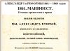
In accordance with the Constitution of the USSR, adopted on October 7, 1977, the Khanty-Mansiysk National Okrug received autonomous status and became known as the Khanty-Mansiysk Autonomous Okrug. The 1993 Constitution made the region an equal subject Russian Federation. He has own territory, Charter, coat of arms, flag, forms legislative bodies, state power and local self-government, has property, the right of legislative initiative in State Duma, representation in the Federation Council.
On July 25, 2003, by Decree of the President of the Russian Federation, a significant semantic clarification was made to the Charter of the Khanty-Mansiysk Autonomous Okrug - the Okrug was named Khanty-Mansiysk Autonomous Okrug - Ugra.
Currently, the autonomous district includes 22 municipalities, of which 9 districts are Beloyarsky, Berezovsky, Kondinsky, Nefteyugansk, Nizhnevartovsky, Oktyabrsky, Sovetsky, Surgutsky, Khanty-Mansiysk, and 13 cities - Kogalym, Langepas, Megion, Nefteyugansk, Nizhnevartovsk, Nyagan, Pokachi, Pyt-Yakh, Raduzhny, Surgut, Urai, Khanty-Mansiysk, Yugorsk.
Geography and climatic conditions
Khanty-Mansiysk Autonomous Okrug-Ugra located in the middle of Russia and the Eurasian continent. From west to east, the region's territory extends 1,400 km from the eastern slopes of the Northern Urals almost to the banks of the Yenisei; from north to south - 900 km from Siberian Uvaly to Kondinskaya taiga. Extreme northern point located at the source of the river. Khulga in the Berezovsky district, the southernmost one is near the urban-type settlement of Kuminsky, the westernmost one is in the mountains of the Northern Urals at the source of the river. Northern Sosva, easternmost - at the source of the river. Wow. In the north, the district borders with the Yamalo-Nenets Autonomous Okrug, in the north-west - with the Komi Republic, in the south-west - with the Sverdlovsk region, in the south - with the Tobolsk and Uvat districts of the Tyumen region, in the south-east and east - with the Tomsk region And Krasnoyarsk Territory. The entire territory of Ugra belongs to the regions of the Far North. 
The boundaries of the region are determined by the decree of the Presidium of the All-Russian Central Executive Committee of December 10, 1930 “On the organization of national associations in areas of settlement of small nationalities of the North.” Yugra includes the territories of the cities of district significance: Beloyarsky, Kogalym, Langepas, Megion, Nefteyugansk, Nizhnevartovsk, Nyagan, Pokachi, Pyt-Yakh, Raduzhny, Surgut, Urai, Khanty-Mansiysk, Yugorsk, the territories of Beloyarsky, Berezovsky, Kondinsky, Nefteyugansk, Nizhnevartovsk, Oktyabrsky, Sovetsky, Surgut and Khanty-Mansiysk regions.
The district borders simultaneously with six constituent entities of the Russian Federation. Located in the zone of taiga forests and swamps. The region's topography is varied: there are plains, foothills and mountains on its territory. Highest points- Mount Narodnaya (1895 m) in the Subpolar Urals and Mount Pedy (1010 m) in the Northern Urals.
In the Khanty-Mansiysk Autonomous Okrug there are two large rivers: Ob, 3650 km long, and its tributary Irtysh, 3580 km long. The tributaries of these rivers are also comparable to large water arteries. For example, the Great Yugan and Vakh (tributaries of the Ob) are compared with the Vistula and Odra. A tributary of the Irtysh, the Konda River is comparable to the Rhine. Almost all rivers in the district have a low flow rate and are characterized by spring and summer overflows and floods. A third of the district's territory is occupied by swamps. Surrounded by swamps and forests there are about 300 thousand lakes.
The climate of the district is temperate continental. It is characterized by sudden changes in weather in spring and autumn, and temperature changes during the day. Winters are long, snowy and cold. Frosts can set in for several weeks with air temperatures below minus 30 degrees. Summer is short and warm.
Administrative-territorial structure and population
The Khanty-Mansiysk Autonomous Okrug-Ugra is divided into 9 districts, 13 urban districts, 26 urban-type settlements, 58 rural settlements.
Initially, with the formation of the Khanty-Mansiysk Autonomous Okrug in 1930 as part of the Ural region, Ugra was divided into 6 districts: Berezovsky, Kondinsky, Laryaksky, Samarovsky, Surgutsky, Shuryshkarsky. The creation of the Lumpokol district was also envisaged, but it was never formed. After 7 years, the Shuryshkarsky district became part of the Yamalo-Nenets National District. In 1957, Mikoyanovsky district was renamed Oktyabrsky. Laryaksky district received the name Nizhnevartovsky in 1962. And soon the Samarovsky district became the Khanty-Mansiysk. In the 60s-80s, new territories were formed in the Khanty-Mansiysk Okrug. During this period, the Sovetsky, Nefteyugansk and Beloyarsk regions appeared.
The administrative-territorial division of the Khanty-Mansiysk Autonomous Okrug - Ugra is based on the principles of historical settlement, location of mining enterprises in development territories natural resources, efficiency of state and local self-government and maximum use of the economic potential of the region. All solutions to issues related to boundary changes settlements, are adopted taking into account the opinion of the population.
The preliminary estimate of the population of the Autonomous Okrug at the beginning of 2013 was 1583.9 thousand people. (3rd place in the Ural Federal District and 27th place in the Russian Federation). This is the largest region in terms of population, the territory of which is equal to the regions of the Far North.
The Autonomous Okrug is characterized high degree urbanization. The share of the urban population at the beginning of 2013 was 91.8%.
District Economic Complex
The specificity of the district's economy is mono-industry with a raw material orientation. Most emerging industries: mining, chemical production, energy and construction.
Yugra's share in all-Russian oil production in 2012 was 50.2%. During this period, 259.9 million tons were produced in the territory of the Autonomous Okrug. There are 10 vertically integrated companies operating in the region oil companies and 14 independent manufacturers. The largest subsoil users are OJSC NK Rosneft, OJSC Surgutneftegaz, OJSC NK LUKOIL, TNK-BP. Since 1964, when fields began to be intensively developed in Ugra, 10,219.97 million tons of oil have been produced.
The share of the Autonomous Okrug in the total volume of gas production in Russia is 4.9%. In 2012, 32.3 billion cubic meters were extracted. m. - this is 2.4% more than in the previous one.
The resources of the Autonomous Okrug ensure the energy security of the country and create the necessary basis for further development economic complex, form the basis of its export potential.
In terms of explored and confirmed hydrocarbon reserves, production capabilities, the state of production infrastructure and the profitability of development, the Autonomous Okrug remains the main strategic resource base hydrocarbon raw materials of Russia.
6 enterprises process oil and gas products in Ugra. Eight gas processing enterprises are engaged in the utilization of associated petroleum gas.
Over the past three decades, the most powerful electric power complex in the country has been created in the region. The main share of electricity generation in the territory of the Autonomous Okrug is provided by OJSC “Surgutskaya GRES-1”, OJSC “Surgutskaya GRES-2” and OJSC “Nizhnevartovskaya GRES”. Their total capacity is more than 10.5 thousand MW.
 Every year in Ugra the volume of construction work. In 2012, more than 1 million square meters of housing were commissioned. This figure was achieved for the first time since 1990. Mortgage lending is actively developing: in the ranking of regions of the Russian Federation, the district took 2nd place in terms of the number of loans provided.
A well-developed network of modern road, rail, waterways, intensive air traffic with cities in Russia and abroad is one of the determining factors effective development economic ties. Two of the 18 main road corridors of Russia pass through the territory of Ugra: the “Northern Route” (Perm - Serov - Ivdel - Khanty-Mansiysk - Nefteyugansk - Surgut - Nizhnevartovsk - Tomsk) and the "Siberian Corridor" (Tyumen - Surgut - Novy Urengoy-Nadym - Salekhard).
The Khanty-Mansiysk Autonomous Okrug - Ugra is an export-oriented region, and in the total volume of foreign trade turnover, the share of exports is 95.8%, and the share of imports is 4.2%. The following products are exported: mineral fuel, oil and their distillation products, bituminous substances, mineral waxes; wood, charcoal. Of the total export volume - 99.4% - is crude oil. Import of goods and services into the region for last year decreased by 25.5%. The following is imported to Ugra: aircraft; boilers, equipment and mechanical devices, their parts; ferrous metal products; electrical machines and equipment.
The development of innovations occupies a special place in the economy of Ugra. There are 90 employees in the region innovative companies, most of whom are residents of the Technopark. The Autonomous Okrug is introducing a standard for the activities of the executive bodies of state power of the Autonomous Okrug to ensure a favorable investment climate (hereinafter referred to as the Standard). The standard is designed to improve the investment climate in the Autonomous Okrug and, taking into account the best regional practices, create minimum required conditions for increasing the influx of investment into the Autonomous Okrug.
To support subjects innovation activity in the region the following were created: an autonomous institution of the Khanty-Mansiysk Autonomous Okrug - Ugra “Technopark” high technology”; non-profit organizations: “Ugra Entrepreneurship Support Fund”; “Fund for promoting the development of investments in small and medium-sized businesses in the Khanty-Mansiysk Autonomous Okrug - Ugra “Microfinance Fund of the Khanty-Mansiysk Autonomous Okrug - Ugra”. Support is also provided by the Ugra Center for Technology Transfer (based on the UNII IT) and Okruzhny Business Incubator LLC. 
The main priority for the development of the construction industry of the Autonomous Okrug in the forecast period is the creation of new and technical re-equipment of existing production facilities for the production of building materials, which is necessary to ensure the increasing volumes of construction work in subsequent years as part of the implementation of national projects.
The socio-economic policy of the Khanty-Mansiysk Autonomous Okrug is aimed, first of all, at creating comfortable living conditions for the population, increasing the level and quality of life of Ugra residents.
At the end of the year, the volume of housing commissioned amounted to 1,021 thousand square meters. m.
As a result, the housing supply for the average citizen of the Autonomous Okrug in 2012 amounted to 19.6 square meters. meters, increasing by 0.6 m compared to 2011. In the medium term, about 15 billion rubles are projected to be spent annually on housing construction, which will increase the housing supply in the Autonomous Okrug in 2015 to 20.9 square meters. m.
Flora and fauna
Plants
 Flora Khanty-Mansiysk Okrug has over 800 species of higher plants. Almost the entire territory of the district is located within one natural area- taiga forests, only in the extreme north-west in the Urals part it enters the forest-tundra and mountain tundra zone. Most of the territory is occupied by heavily swampy taiga. The vegetation is represented by communities of mixed and coniferous forests, swamps, water meadows, reservoirs, mountain tundras. IN northern regions the composition of vegetation is greatly influenced by permafrost. The forest cover of the territory is 52%. The middle taiga zone dominates, which is represented by dark-coniferous, light-coniferous, small-leaved and mixed forests. Spruce, cedar, fir, pine, larch, birch, and alder grow in them. Of particular note are the vast light lichen forests, widespread in the northern regions of the district, used as deer pastures. River floodplains and lowlands are characterized by meadow vegetation. High floodplains of large rivers are often covered with park-type willow forests, willow-birch, willow-birch-aspen grass forests. Forests and swamps are rich in berries: cranberries, lingonberries, blueberries, blueberries, currants, cloudberries, raspberries, rose hips, bird cherry, rowan. About 200 plant species are used in traditional indigenous medicine.
Fauna
The fauna of the district is typical for the taiga zone of Russia. The vertebrate fauna includes 369 species. Mammals are represented by 60 species, 28 of which are commercial. The most common and valuable in economically are: fox, arctic fox, squirrel, sable, marten, ermine, weasel, polecat, mink, weasel, otter, hare, wild reindeer, elk, etc. Wolverine and West Siberian river beaver are included in the Red Book of Russia.
The district's avifauna is represented by 256 bird species, including 206 resident and nesting species. The most numerous orders are Passeriformes, Charadriiformes and Anseriformes. The basis of the hunting fauna (48 species) is formed by geese, wood grouse, black grouse, hazel grouse, partridges, ducks, and waders. Of the predators, special mention should be made of the vulture hawk, marsh harrier, and long-eared owl. There are rare species listed in the Red Book: Dalmatian Pelican, Black Stork, Common Flamingo, Lesser Lesser Lesser Lesser Lesser Lesser Lesser White-fronted Lesser, Golden Eagle, Peregrine Falcon, Black Crane, Siberian Crane (White Crane), Slender-billed Curlew, White-tailed Eagle, Osprey, Gyrfalcon, Brent Goose, Red-breasted Goose. There are 42 species of fish in rivers and lakes. Only 19 of them are commercial - these are sterlet, lelma, muksun, peled (cheese), whitefish (pizhyan), Sosvinskaya herring (tugun), burbot, pike, ide, roach, bream, dace, perch, ruff , gold and silver crucian carp, and carp are grown in the cooling ponds of the Surgut and Nizhnevartovsk State District Power Plants. The species listed in the Red Book is the sturgeon. 
The area is notorious for the abundance of mosquitoes and midges. Huge number blood-sucking insects is a significant nuisance for domestic animals and workers outdoors people. So, for example, average number adult mosquitoes in the forest area in the Ob and its tributaries range from 4 to 12 specimens per 1 sq.m of territory. Mosquitoes appear in late May - mid-June, and their mass emergence occurs in early July. By the end of August, the number and activity of mosquitoes decreases significantly. The period of greatest activity of midges, when they attack people, occurs in the second half of summer.
Map of Khanty-Mansi Autonomous Okrug-Yugra with cities and regions
There is one of the most unique places in Russia. It is called KHMAO. IN given time became part of the Tyumen region. This beautiful place is located in the federal Ural District. Check out the exact details at detailed map Khanty-Mansi Autonomous Okrug with cities and regions. The regional administrative center is Khanty-Mansiysk. Near it there are cities such as: Surgut, Nefteyugansk, Nizhnevartovsk and so on. The border passes near the Krasnoyarsk Territory, the Komi Republic, Nenets District, Sverdlovsk, Tomsk, Tyumen regions.
The climate in this ecological clean place continental temperate. Transition periods are carried out quickly. Arctic masses have strong influence for the weather. Khanty-Mansi Autonomous Okrug Map(Ugra) is able to tell many amazing facts.
Once upon a time, around the beginning of the last century, the Vogul-Ostyaki national district was formed. Then it was renamed and became part of the Omsk region. Much has changed over time. Now the Khanty-Mansiysk Autonomous Okrug is an independent entity.
The local population at last count is more than a million people. Territorially – administrative division provided municipal districts, cities of district significance, urban and rural settlements.
Khanty-Mansiysk Autonomous Okrug - Ugra.
The Yugansky Nature Reserve was founded in 1982 as the largest taiga landscape reserve. It occupies an area of 648.7 thousand hectares, has a two-kilometer security zone with an area of 98.9 thousand hectares along the perimeter. The territory of the reserve includes part of the basins of the Negusyakh and Maly Yugan rivers - the right tributaries of the Big Yugan.
A memorial sign to the “Discoverers of the Ugra Land” is a stele rising 62 meters above Khanty-Mansiysk. It is a pyramid, each of the faces of which represents one of the eras of the region’s development: ancient times, annexation to Russia, modern stage life. The pyramid is especially beautiful at night - a special light is used to illuminate it. computer program, which creates up to a hundred different shades.
Archeopark is one of the main attractions of the city. This unique complex is located at the very foot of ancient mountain The Samarovsky outlier is an extraordinary park that combines monuments
geology (outcropping of a remnant), and archeology (“Samarov town”), and monuments of monumental art depicting various animals that lived in these places about 15 thousand years ago. The most memorable among them is a herd of bronze mammoths. There is also a sculptural composition “Parking ancient man", and "A Herd of Ancient Horses", and even "Wooly Rhinoceroses".
Monument "Bronze Symbol of Ugra". There are many different monuments and sculptural compositions in Khanty-Mansiysk. And the symbol of Ugra is a 12-meter bronze female figure, installed in honor of the 75th anniversary of the Autonomous Okrug. This monument symbolizes the maternal origin of Ugra, uniting representatives of the indigenous peoples of the North, oil workers, scientists, and residents of the district, whose figures are also included in the sculptural composition.
Orthodox complex “In the name of the Resurrection of Christ” this beautiful Orthodox complex is one of the most important attractions of Khanty-Mansiysk. It was built in best traditions Russian architecture of the 19th century in honor of the 2000th anniversary of the Nativity of Christ.
The Khanty-Mansiysk Autonomous Okrug was formed in 1930, until 1940 it was called the Ostyak-Vogul National Okrug. It is located in the Tyumen region in the Ural Federal District.
The district is located in the center of the West Siberian Lowland. It borders with the Yamalo-Nenets Autonomous Okrug, Krasnoyarsk Territory, Tomsk, Tyumen, Sverdlovsk regions and the Komi Republic.
Area - 534.8 thousand square kilometers. The district includes 9 districts and 13 urban districts. Administrative center- city of Khanty-Mansiysk. Major cities— Surgut, Nefteyugansk, Nizhnevartovsk.
The population of the district, according to Rosstat data as of January 1, 2014, was 1597.0 thousand people. IN national composition The population of the district is dominated by Russians, Ukrainians, Tatars, and Bashkirs.
The indigenous (aboriginal) population is represented by three small nationalities - the Khanty, Mansi and Forest Nenets. Their total number is about 1.5%.
Governor of Khanty-Mansi Autonomous Okrug - Natalya Komarova (since 2010).
Two large rivers flow through the territory of the district: the Ob, with a length of 3,650 kilometers, and its tributary, the Irtysh, with a length of 3,580 kilometers. The climate of the district is temperate continental. It is characterized by sudden changes in weather in spring and autumn, and temperature changes during the day.
The district occupies most of the territory of the West Siberian oil and gas province and is one of the largest oil-producing regions in the world. About 7% of the world's oil and about half of Russian oil, and more than 4% of the volume of all-Russian gas are produced here.
As of 2013, on the territory of the Autonomous Okrug, 467 hydrocarbon deposits were included in the balance sheet, including 406 oil fields, 22 gas and gas condensate, 39 oil and gas condensate, oil and gas and gas and oil. The largest are Samotlorskoye, Fedorovskoye, Mamontovskoye, Priobskoye.
The largest volume of oil recovered was from the Surgut, Nizhnevartovsk, Nefteyugansk and Khanty-Mansiysk regions.
In 2014, the region produced 250.5 million tons of oil, 31,771.5 million cubic meters natural and associated gas.
Most of the oil reserves of the distributed subsoil fund (95%) are listed on the balance sheet of the largest vertically integrated oil companies OJSC TNK-BP Holding, OJSC Rosneft, OJSC LUKOIL, OJSC Surgutneftegaz, OJSC Slavneft, OJSC Gazprom Neft and JSC Russneft.
Placer gold is mined in the district (forecast gold reserves exceed 216 tons), vein quartz and collection raw materials. Deposits of brown and coal. Deposits discovered iron ores, copper, zinc, lead, niobium, tantalum, manifestations of bauxite, etc.
The region has created the most powerful electric power complex in the country. The main share of electricity generation in the territory of the Autonomous Okrug is provided by OJSC "Surgutskaya GRES-1", OJSC "Surgutskaya GRES-2", OJSC "Nizhnevartovskaya GRES" and "Nyaganskaya GRES".
The Khanty-Mansiysk Autonomous Okrug - Ugra is an export-oriented region, in the total volume of foreign trade turnover the share of exports is 95.6%, the share of imports is 4.4%. Mineral fuels, oil and their distillation products, bituminous substances, mineral waxes are exported; wood, charcoal. Of the total export volume, 99.4% is crude oil.
The development of innovations occupies a special place in the economy of Ugra. To support subjects of innovative activity in the region, the following have been created: the autonomous institution of the Khanty-Mansiysk Autonomous Okrug - Ugra "Technopark of High Technologies", non-profit organizations "Ugra Entrepreneurship Support Fund"; "Development Fund of the Khanty-Mansiysk Autonomous Okrug - Ugra", "Microfinance Fund of the Khanty-Mansiysk Autonomous Okrug - Ugra". There are 130 innovative companies operating in the region, most of which are residents of the Technopark.
All research activities of Ugra are concentrated in higher educational institutions districts.
Higher education system vocational education Khanty-Mansi Autonomous Okrug consists of two regional universities and an academy, as well as two federal universities— Yugorsky state university and Nizhnevartovsk State University.
18 small innovative enterprises have been created at universities. They are engaged research activities, in which students also participate.
On the territory of the Autonomous Okrug there are historical and cultural monuments: museums, theaters, archaeological complexes. There are 35 museums and their branches in Ugra. Most museums are historical, local history and ethnographic.
In Khanty-Mansiysk there is an ethnographic museum under open air"Torum Maa", founded in 1987. The museum is broadcasting living culture indigenous small peoples North. In addition to exhibiting rare objects, the Torum Maa Museum holds ritual holidays of the indigenous peoples of the North.
In the district there are two state reserves - Yugansky and Malaya Sosva, four natural parks, eight reserves.
Every year the district center becomes a platform for international cinema. Guests and participants of the festival of cinematic debuts "Spirit of Fire" are coming to Ugra. It was established by the government of the Khanty-Mansiysk Autonomous Okrug and the Ministry of Culture of the Russian Federation in 2002.
The material was prepared based on information from open sources
General information about the district
The Khanty-Mansiysk Autonomous Okrug was formed by the resolution of the All-Russian Central Executive Committee of December 10, 1930 “On the organization of national associations in the areas of settlement of small nationalities of the North” and was part of the Ural region. The first name of the region is Ostyak-Vogul National District.
Geographical location. Borders of the Khanty-Mansiysk Autonomous Okrug-Ugra
The Khanty-Mansiysk Autonomous Okrug-Ugra is located in the center of the West Siberian Lowland. Its territory stretches from west to east for almost 1,400 km, from north to south – 900 km. The length of the borders is 4,733 km. The district covers an area of 534.8 thousand square meters. km.
Territorial organization On the territory of the Khanty-Mansiysk Autonomous Okrug - Ugra, 105 municipalities(9 districts, 13 urban districts, 26 urban and 57 rural settlements) and there are 195 settlements: 16 cities (of which 14 have the status of “city of district significance”) 24 urban villages 58 villages 52 villages. The administrative center of the Khanty-Mansiysk Autonomous Okrug - Ugra is the city of Khanty-Mansiysk. Initially, with the formation of the Khanty-Mansiysk Autonomous Okrug in 1930 as part of the Ural region, Ugra was divided into 6 districts: Berezovsky, Kondinsky, Laryaksky, Samarovsky, Surgutsky, Shuryshkarsky. The creation of the Lumpokol district was also envisaged, but it was never formed. After 7 years, the Shuryshkarsky district became part of the Yamalo-Nenets National District. In 1957, Mikoyanovsky district was renamed Oktyabrsky. Laryaksky district received the name Nizhnevartovsky in 1962. And soon the Samarovsky district became the Khanty-Mansiysk. In the 60-80s, new territories were formed in the Khanty-Mansiysk Okrug. During this period, the Sovetsky, Nefteyugansk and Beloyarsk regions appeared. The administrative-territorial division of the Khanty-Mansiysk Autonomous Okrug - Ugra is based on the principles of historical settlement, the location of mining enterprises in the territories of natural resource development, the efficiency of state and local self-government and the maximum use of the economic potential of the region. All decisions on issues related to territorial organization are made taking into account the opinion of the population.
Settlement history
The first evidence of people inhabiting the territory of modern Ugra dates back to the Mesolithic era. IN early Middle Ages The formation of the Khanty and Mansi ethnic groups began. By the 10th century they inhabit vast areas from the Urals to the Yenisei and from the Ob to the Baraba steppes.
Formation of statehood
The modern Khanty-Mansi Autonomous Okrug - Ugra - is a full-fledged subject of the Russian Federation, adjacent to the Yamalo-Nenets Autonomous Okrug, the south of the Tyumen region, the Komi Republic, Sverdlovsk, Tomsk regions and Krasnoyarsk Territory. However, in the history of the Yugra land, its borders often changed, and it itself was part of various Russian regions.
West Siberian oil and gas province
The first Soviet geological expedition arrived on Ugra land in February 1935. It was headed by 24-year-old engineer-geologist Viktor Grigorievich Vasiliev. It was he who first confirmed natural oil seeps on the surface of the Yugan River in the Surgut region. 2.5 tons of equipment were sent to the drilling site by plane.
Economy
The Khanty-Mansiysk Autonomous Okrug - Yugra is the main oil and gas bearing region of Russia and one of the largest oil-producing regions in the world, belongs to the donor regions of Russia and is a leader in a number of major economic indicators:
Business
In the Khanty-Mansiysk Autonomous Okrug - Ugra, there are 23.5 thousand small and medium-sized businesses (excluding individual entrepreneurs). The number of employees of small and medium-sized enterprises as of January 1, 2014 amounted to 122.9 thousand people. And in the volume of gross regional product, the share of small and medium-sized enterprises amounted to 15.5%. Every second of them received government support in 2013.
Interregional and international cooperation
International and interregional cooperation provides Ugra with ample opportunities to study advanced foreign experience, receiving consulting assistance from leading world experts, attracting additional financial resources, helps strengthen the political and socio-economic situation of the region.
Healthcare
At the very beginning of the century, the Russian scientist, economist, and ethnographer Dunin Gorkavich, having visited our northern places, wrote: “The situation medical care here it is such that, with all the desire, it is not able to satisfy the population. In the entire region there are 100 taverns, 80 churches, 35 schools and only 2 hospitals.”
Education
The government of Ugra is actively addressing the issue of shortage of places in kindergartens. To reduce the intensity of this problem, a number of measures have been taken to stimulate the development of the services market preschool education, creation of short-stay groups, preschool groups based on educational organizations, organizations additional education children, departmental kindergartens, non-governmental organizations.
Ecology
Khanty-Mansiysk Autonomous Okrug - Ugra has a huge natural resource potential, is the main oil and gas bearing region of Russia and one of the largest oil producing regions in the world. Natural capital is one of the main components sustainable development territory, it serves as the foundation economic growth and improving the well-being of the population.
Science
In Ugra scientific activity conducted by 1,345 employees of higher professional education organizations. More than 50% of scientific and pedagogical workers have academic degrees and titles, 16.3% - academic degree Doctor of Sciences
Culture There are 482 cultural institutions in Ugra. Museum of Nature and Man- the oldest museum institution in its collections has unique exhibits of archeology and paleontology, including the only known mammoth vertebra in the world, pierced by an arrow of an ancient man, objects material culture and the life of the inhabitants of Ugra in the early Middle Ages.
Traditional trades and crafts of indigenous peoples of the North
The culture of the Ob Ugrians presumably developed by the 14th-16th centuries. Until this time, Russian people called the settlement area Ugric groups and its inhabitants - “Yugra”.
Means mass media
The district newspaper "News of Yugra", the state television and radio company "Yugoria", the district television and radio company "Ugra" are the largest media in the region.
Sport
Ugra is known outside its borders as a venue for major international and all-Russian sports competitions. More than 400 mass sports events of the district, all-Russian and international level are held annually in the Autonomous Okrug.
Tourism
The Khanty-Mansiysk Autonomous Okrug - Ugra has unique natural, cultural and historical resources for the development of recreation and tourism. On the territory of the Autonomous Okrug there are historical and cultural monuments: museums, theaters, archaeological complexes, as well as modern infrastructure for lovers of cultural, educational, recreational and active recreation.